Walnut Park West | |
|---|---|
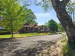 Walnut Park West houses near Goodfellow and Emma, May 2018 | |
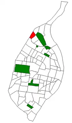 Location (red) of Walnut Park West within St. Louis | |
| Country | United States |
| State | Missouri |
| City | St. Louis |
| Wards | 27 |
| Area | |
| • Total | 0.43 sq mi (1.1 km2) |
| Population (2020)[1] | |
| • Total | 2,561 |
| • Density | 6,000/sq mi (2,300/km2) |
| ZIP code(s) | Part of 63136 |
| Area code(s) | 314 |
| Website | stlouis-mo.gov |
Walnut Park West is a neighborhood of St. Louis, Missouri. The Walnut Park West neighborhood is situated in northwest St. Louis. It is bounded by West Florissant Avenue to the northeast, Riverview Boulevard to the southeast, Interstate Highway 70 (I-70) to the south, and the City limits (St. Louis County and the City of Jennings) to the west and northwest.
Demographics
| Census | Pop. | Note | %± |
|---|---|---|---|
| 1990 | 4,610 | — | |
| 2000 | 4,235 | −8.1% | |
| 2010 | 3,349 | −20.9% | |
| 2020 | 2,561 | −23.5% | |
| Sources:[2][3] | |||
In 2010 Walnut Park West's racial makeup was 95.1% Black, 0.8% White, 0.1% Asian, 0.2% American Indian, 3.4% Two or More Races, and 0.4% Some Other Race. 0.8% of the population was of Hispanic or Latino origin.[4]
References
- ↑ 2020 Census Neighborhood Results
- ↑ "Walnut Park West Statistics". St Louis, MO. Retrieved 8 August 2023.
- ↑ ""Census"".
- ↑ "City of St. Louis - Neighborhood Population & Demographics - Census 2020 P.L. 94-171 Redistricting Data Release" (PDF). Archived from the original (PDF) on 2021-08-26.
38°42′21″N 90°15′24″W / 38.7057°N 90.2567°W
This article is issued from Wikipedia. The text is licensed under Creative Commons - Attribution - Sharealike. Additional terms may apply for the media files.