Kingsway West | |
|---|---|
.jpg.webp) Buildings on Union Boulevard in Kingsway West, December 2010 | |
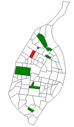
 Location (red) of Kingsway West within St. Louis | |
| Country | United States |
| State | Missouri |
| City | St. Louis |
| Wards | 1, 18, 26 |
| Area | |
| • Total | 0.42 sq mi (1.1 km2) |
| Population (2020)[1] | |
| • Total | 2,604 |
| • Density | 6,200/sq mi (2,400/km2) |
| ZIP code(s) | Parts of 63113, 63115 |
| Area code(s) | 314 |
| Website | stlouis-mo.gov |
Kingsway West is a neighborhood of St. Louis, Missouri. The Kingsway West neighborhood is defined by Union Boulevard to its north-west and Dr. Martin Luther King Drive to its south-west. Natural Bridge Avenue forms its north-east boundary and North Kingshighway is its southeast boundary.
Characteristics
.jpg.webp)
The Academy neighborhood has a mix of large single-family homes as well as two and four-family structures. Kings Heights is a newer development of condominiums and attached townhomes in a private setting. The area is experiencing new residential construction on Norwood Square. There is a stretch of businesses and other commercial uses along Natural Bridge Boulevard which goes through the neighborhood.
Churches
- Cote Brilliante Presbyterian Church 4673 Labadie Avenue, St. Louis, MO 63115.
- Friendly Missionary Baptist Church 5164 Lexington Avenue, St. Louis, MO 63115
- Immanuel Lutheran Church 3540 Marcus (at Lexington), St. Louis, MO 63115.
- Memorial Boulevard Christian Church 3000 North Kingshighway, St. Louis, MO 63114.
- Most Blessed Sacrament Catholic Church 5017 Northland Avenue, St. Louis, MO 63113.[2]
Demographics
| Census | Pop. | Note | %± |
|---|---|---|---|
| 1990 | 4,182 | — | |
| 2000 | 3,886 | −7.1% | |
| 2010 | 3,441 | −11.5% | |
| 2020 | 2,604 | −24.3% | |
| Sources: [3][4] | |||
In 2020 Kingshighway West's population was 89.6% Black, 7.0% White, 0.1% Native American, and 2.6% Two or More Races. 0.6% of the population was of Hispanic or Latino origin.[5]
References
- ↑ "2020 Census Neighborhood Results".
- ↑ "Churches". Archived from the original on 2011-06-07.
- ↑ "2010 Census" (PDF).
- ↑ "2010 Census" (PDF).
- ↑ "City of St. Louis" (PDF).
External links
- Kingsway West neighborhood website
38°40′17″N 90°15′37″W / 38.6713°N 90.2602°W