Botanical Heights | |
|---|---|
_(8132962042).jpg.webp) Houses in Botanical Heights, October 2012 | |
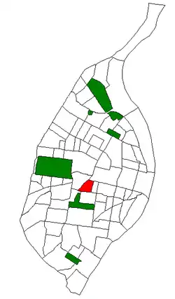 Location (red) of Botanical Heights within St. Louis | |
| Country | United States |
| State | Missouri |
| City | St. Louis |
| Wards | 17 |
| Area | |
| • Total | 0.41 sq mi (1.1 km2) |
| Population (2020)[1] | |
| • Total | 1,196 |
| • Density | 2,900/sq mi (1,100/km2) |
| ZIP code(s) | Part of 63110 |
| Area code(s) | 314 |
| Website | stlouis-mo.gov |
Botanical Heights is a neighborhood of St. Louis, Missouri. Its former name was McRee Town. The Botanical Heights neighborhood is defined by Chouteau Avenue on the North, Interstate 44 on the South, 39th Street on the East and Vandeventer Avenue on the West. This near Southside neighborhood is located just north of the Shaw neighborhood.[2]
Demographics
| Year | Pop. | ±% |
|---|---|---|
| 1990 | 3,152 | — |
| 2000 | 1,818 | −42.3% |
| 2010 | 1,037 | −43.0% |
| 2020 | 1,196 | +15.3% |
In 2020 Botanical Heights' population was 50.0% Black, 37.2% White, 0.3% Native American, 3.3% Asian, 7.3% Two or More Races, and 1.6% Some Other Race. 5.0% of the neighborhood's population was of Hispanic or Latino origin, 20.3% have a High school education.[3]
| Racial composition | 2000[4] | 2010[5] | 2020[6] |
|---|---|---|---|
| White | 6.8% | 20.3% | 37.2% |
| Black or African American | 89.4% | 74.4% | 50.0% |
| Hispanic or Latino (of any race) | 2.4% | 2.1% | 5.0% |
| Asian | 0% | 1.7% | 3.3% |
See also
- Grand Boulevard, nearby major road and commercial area to the east
- The Grove, an up-and-coming business and nightlife district to the west
- Missouri Botanical Garden
- Midtown St. Louis, the nearby area
References
- ↑ "2020 Census Neighborhood Results".
- ↑ Neighborhood Data Profile for Botanical Heights Archived September 2, 2009, at the Wayback Machine
- ↑ "City of St. Louis" (PDF). Retrieved 2021-09-14.
- ↑ "The City of St. Louis Missouri". City of St. Louis.
- ↑ "The City of St. Louis Missouri". City of St. Louis.
- ↑ (PDF). City of St. Louis https://www.stlouis-mo.gov/government/departments/planning/research/documents/upload/Total-Population-by-Neighborhood-Census-2020-Redistricting-Release-2.pdf.
{{cite web}}: Missing or empty|title=(help)
38°37′21″N 90°14′59″W / 38.6224°N 90.2497°W
This article is issued from Wikipedia. The text is licensed under Creative Commons - Attribution - Sharealike. Additional terms may apply for the media files.