Villers-Saint-Christophe | |
|---|---|
_mairie.JPG.webp) The town hall of Villers-Saint-Christophe | |
 Coat of arms | |
Location of Villers-Saint-Christophe | |
 Villers-Saint-Christophe 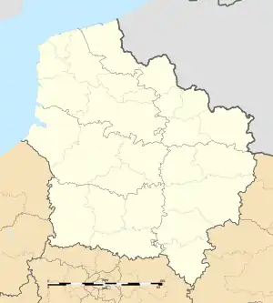 Villers-Saint-Christophe | |
| Coordinates: 49°46′49″N 3°05′38″E / 49.7803°N 3.0939°E | |
| Country | France |
| Region | Hauts-de-France |
| Department | Aisne |
| Arrondissement | Saint-Quentin |
| Canton | Ribemont |
| Intercommunality | CA Saint-Quentinois |
| Government | |
| • Mayor (2020–2026) | Denis Liesse[1] |
| Area 1 | 8.99 km2 (3.47 sq mi) |
| Population | 424 |
| • Density | 47/km2 (120/sq mi) |
| Time zone | UTC+01:00 (CET) |
| • Summer (DST) | UTC+02:00 (CEST) |
| INSEE/Postal code | 02815 /02590 |
| Elevation | 65–96 m (213–315 ft) (avg. 86 m or 282 ft) |
| 1 French Land Register data, which excludes lakes, ponds, glaciers > 1 km2 (0.386 sq mi or 247 acres) and river estuaries. | |
Villers-Saint-Christophe (French pronunciation: [vilɛʁ sɛ̃ kʁistɔf]) is a commune in the Aisne department in Hauts-de-France in northern France.
Population
| Year | Pop. | ±% |
|---|---|---|
| 1962 | 422 | — |
| 1968 | 398 | −5.7% |
| 1975 | 387 | −2.8% |
| 1982 | 437 | +12.9% |
| 1990 | 430 | −1.6% |
| 1999 | 457 | +6.3% |
| 2008 | 460 | +0.7% |
See also
References
- ↑ "Répertoire national des élus: les maires". data.gouv.fr, Plateforme ouverte des données publiques françaises (in French). 2 December 2020.
- ↑ "Populations légales 2021". The National Institute of Statistics and Economic Studies. 28 December 2023.
Wikimedia Commons has media related to Villers-Saint-Christophe.
This article is issued from Wikipedia. The text is licensed under Creative Commons - Attribution - Sharealike. Additional terms may apply for the media files.