Bruyères-et-Montbérault | |
|---|---|
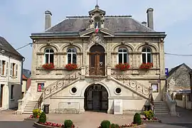 The town hall of Bruyères-et-Montbérault | |
Location of Bruyères-et-Montbérault | |
 Bruyères-et-Montbérault 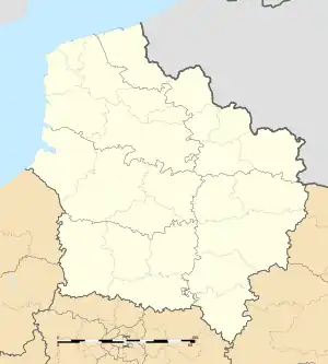 Bruyères-et-Montbérault | |
| Coordinates: 49°31′31″N 3°39′51″E / 49.5253°N 3.6642°E | |
| Country | France |
| Region | Hauts-de-France |
| Department | Aisne |
| Arrondissement | Laon |
| Canton | Laon-2 |
| Intercommunality | CA Pays de Laon |
| Government | |
| • Mayor (2020–2026) | Marie-Pierre Tokarski[1] |
| Area 1 | 11.61 km2 (4.48 sq mi) |
| Population | 1,432 |
| • Density | 120/km2 (320/sq mi) |
| Time zone | UTC+01:00 (CET) |
| • Summer (DST) | UTC+02:00 (CEST) |
| INSEE/Postal code | 02128 /02860 |
| Elevation | 67–199 m (220–653 ft) (avg. 86 m or 282 ft) |
| 1 French Land Register data, which excludes lakes, ponds, glaciers > 1 km2 (0.386 sq mi or 247 acres) and river estuaries. | |
Bruyères-et-Montbérault (French pronunciation: [bʁɥijɛʁ e mɔ̃beʁo]) is a commune in the department of Aisne in Hauts-de-France in northern France.
Population
| Year | Pop. | ±% |
|---|---|---|
| 1962 | 1,030 | — |
| 1968 | 1,073 | +4.2% |
| 1975 | 1,108 | +3.3% |
| 1982 | 1,269 | +14.5% |
| 1990 | 1,410 | +11.1% |
| 1999 | 1,513 | +7.3% |
| 2008 | 1,586 | +4.8% |
See also
References
- ↑ "Répertoire national des élus: les maires" (in French). data.gouv.fr, Plateforme ouverte des données publiques françaises. 13 September 2022.
- ↑ "Populations légales 2021". The National Institute of Statistics and Economic Studies. 28 December 2023.
Wikimedia Commons has media related to Bruyères-et-Montbérault.
This article is issued from Wikipedia. The text is licensed under Creative Commons - Attribution - Sharealike. Additional terms may apply for the media files.