Aubigny-en-Laonnois | |
|---|---|
Commune | |
 | |
Location of Aubigny-en-Laonnois | |
 Aubigny-en-Laonnois  Aubigny-en-Laonnois | |
| Coordinates: 49°29′56″N 3°47′31″E / 49.4989°N 3.7919°E | |
| Country | France |
| Region | Hauts-de-France |
| Department | Aisne |
| Arrondissement | Laon |
| Canton | Villeneuve-sur-Aisne |
| Intercommunality | Chemin des Dames |
| Government | |
| • Mayor (2020–2026) | Thierry Raverdy[1] |
| Area 1 | 4.41 km2 (1.70 sq mi) |
| Population | 101 |
| • Density | 23/km2 (59/sq mi) |
| Time zone | UTC+01:00 (CET) |
| • Summer (DST) | UTC+02:00 (CEST) |
| INSEE/Postal code | 02033 /02820 |
| Elevation | 92–212 m (302–696 ft) |
| 1 French Land Register data, which excludes lakes, ponds, glaciers > 1 km2 (0.386 sq mi or 247 acres) and river estuaries. | |
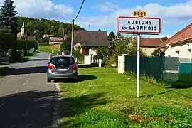
Aubigny-en-Laonnois is a commune in the department of Aisne in the Hauts-de-France region of northern France.
Geography
Aubigny-en-Laonnois is located some 18 km south-east of Laon and 35 km north-west of Rheims. It can be accessed by main highway D1044 which runs along and forms most of the western border of the commune. Access to the village is by the D907 road from Courtrizy-et-Fussigny in the north, changing to the D902 at the commune border and continuing south to the village and south again through the commune to join the D1044. The D90 also runs east from the D1044 forming part of the northern border of the commune and continuing to Saint-Erme-Outre-et-Ramecourt. The D88 also runs west from the D1044 through the south of the commune and continuing to Aizelles. The commune consists of mixed farmland and forests with no other villages or hamlets.[3]
The Ruisseau de Fayau rises in the commune and flows south-east to join the Mielle river east of Corbeny.[3]
Neighbouring communes and villages
Administration

List of Successive Mayors of Aubigny-en-Laonnois[4]
| From | To | Name | Party |
|---|---|---|---|
| 2001 | Present | Thierry Raverdy | DVD |
Population
| Year | Pop. | ±% p.a. |
|---|---|---|
| 1968 | 124 | — |
| 1975 | 85 | −5.25% |
| 1982 | 94 | +1.45% |
| 1990 | 120 | +3.10% |
| 1999 | 114 | −0.57% |
| 2007 | 116 | +0.22% |
| 2012 | 111 | −0.88% |
| 2017 | 105 | −1.11% |
| Source: INSEE[5] | ||
Economy
Agriculture
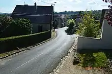
The rolling hills of Aubigny are particularly conducive to the cultivation of strawberries. Strawberries are planted in late summer: August and September. In February, they are mulched and tarpaulined to protect them from spring frosts. Harvest begins in late April or, at the latest, mid-May if it is a very cold year. Strawberries are harvested by hand and placed in 500 g or 250 g trays then sold in the markets of Laon, Saint-Quentin, Charleville-Mézières, and Epernay. In recent years, varieties have multiplied: Gariguette, Ciflorette, Mara des bois, Darselect, and finally the famous forest strawberry (in order of seasonal arrival).
Culture and heritage
Civil heritage
The Chateau Park![]() is registered as an historical monument.[6]
is registered as an historical monument.[6]
See also
References
- ↑ "Répertoire national des élus: les maires". data.gouv.fr, Plateforme ouverte des données publiques françaises (in French). 2 December 2020.
- ↑ "Populations légales 2021". The National Institute of Statistics and Economic Studies. 28 December 2023.
- 1 2 3 "Aubigny-en-Laonnois · 02820, France". Aubigny-en-Laonnois · 02820, France. Retrieved 11 October 2023.
- ↑ List of Mayors of France (in French)
- ↑ Population en historique depuis 1968, INSEE
- ↑ Ministry of Culture, Mérimée IA02001296 Chateau Park (in French)
External links
- Aubigny-en-Laonnois on the old IGN website (in French)
- Aubigny-en-Laonnois on Géoportail, National Geographic Institute (IGN) website (in French)
- Aubigny on the 1750 Cassini Map