Verdun-sur-le-Doubs | |
|---|---|
 A general view of Verdun-sur-le-Doubs | |
.svg.png.webp) Coat of arms | |
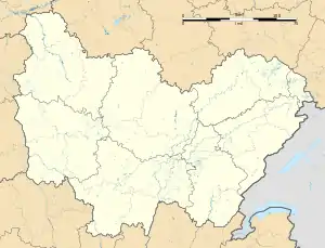
Location of Verdun-sur-le-Doubs | |
 Verdun-sur-le-Doubs  Verdun-sur-le-Doubs | |
| Coordinates: 46°53′49″N 5°01′27″E / 46.8969°N 5.0242°E | |
| Country | France |
| Region | Bourgogne-Franche-Comté |
| Department | Saône-et-Loire |
| Arrondissement | Chalon-sur-Saône |
| Canton | Gergy |
| Intercommunality | Saône Doubs Bresse |
| Area 1 | 7.27 km2 (2.81 sq mi) |
| Population | 960 |
| • Density | 130/km2 (340/sq mi) |
| Time zone | UTC+01:00 (CET) |
| • Summer (DST) | UTC+02:00 (CEST) |
| INSEE/Postal code | 71566 /71350 |
| Elevation | 173–180 m (568–591 ft) (avg. 180 m or 590 ft) |
| 1 French Land Register data, which excludes lakes, ponds, glaciers > 1 km2 (0.386 sq mi or 247 acres) and river estuaries. | |
Verdun-sur-le-Doubs (French pronunciation: [vɛʁdœ̃ syʁ lə du], literally Verdun on the Doubs) is a commune in the Saône-et-Loire department in the region of Bourgogne-Franche-Comté in eastern France.[2]
Position and history
It is in the south-centre of Bourgogne-Franche-Comté at the confluence of the Doubs and the Saône in the Bresse plain, near Beaune and about 20 kilometres (12 mi) north-east of Chalon-sur-Saône.
It has been more than a farmstead since early medieval times and acted as a fortified place at the French kingdom's frontier for several centuries.
As to the German military administration in occupied France during World War II Verdun-sur-le-Doubs was on the north-south Demarcation Line.
Community of communes
Since 2014, Verdun-sur-le-Doubs is part of the Communauté de communes Saône Doubs Bresse.[2]
Economy
Today it is, aside from retirement, a highly agricultural and touristic local economy well known for fishing, river boating, local produce and cuisine. Pôchouse is the local dish of various freshwater fish, dry Burgundy white wine (Bourgogne aligoté), cream, herbs and seasoning.
See also
References
- ↑ "Populations légales 2021". The National Institute of Statistics and Economic Studies. 28 December 2023.
- 1 2 Commune de Verdun-sur-le-Doubs (71566), INSEE


