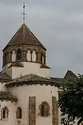
Palinges | |
|---|---|
Commune | |
 | |
 Coat of arms | |
Location of Palinges | |
 Palinges 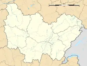 Palinges | |
| Coordinates: 46°33′00″N 4°13′00″E / 46.55°N 4.2167°E | |
| Country | France |
| Region | Bourgogne-Franche-Comté |
| Department | Saône-et-Loire |
| Arrondissement | Charolles |
| Canton | Charolles |
| Area 1 | 36.55 km2 (14.11 sq mi) |
| Population | 1,442 |
| • Density | 39/km2 (100/sq mi) |
| Time zone | UTC+01:00 (CET) |
| • Summer (DST) | UTC+02:00 (CEST) |
| INSEE/Postal code | 71340 /71430 |
| Elevation | 251–328 m (823–1,076 ft) (avg. 270 m or 890 ft) |
| 1 French Land Register data, which excludes lakes, ponds, glaciers > 1 km2 (0.386 sq mi or 247 acres) and river estuaries. | |
Palinges (French pronunciation: [palɛ̃ʒ]) is a commune in the Saône-et-Loire department in the region of Bourgogne-Franche-Comté in eastern France.
Geography
The Bourbince flows south through the middle of the commune.
Sights
Palinges has one of the exceptional chateaus in Saône-et-Loire, the Château de Digoine.
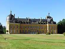
Château de Digoine
See also
References
- ↑ "Populations légales 2021". The National Institute of Statistics and Economic Studies. 28 December 2023.
Wikimedia Commons has media related to Palinges.
This article is issued from Wikipedia. The text is licensed under Creative Commons - Attribution - Sharealike. Additional terms may apply for the media files.