Vazeilles-Limandre | |
|---|---|
Commune | |
 | |
.svg.png.webp) Coat of arms | |
Location of Vazeilles-Limandre | |
 Vazeilles-Limandre 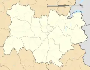 Vazeilles-Limandre | |
| Coordinates: 45°06′51″N 3°41′57″E / 45.1142°N 3.6992°E | |
| Country | France |
| Region | Auvergne-Rhône-Alpes |
| Department | Haute-Loire |
| Arrondissement | Le Puy-en-Velay |
| Canton | Saint-Paulien |
| Intercommunality | CA du Puy-en-Velay |
| Government | |
| • Mayor (2020–2026) | Yves Tafin[1] |
| Area 1 | 11.72 km2 (4.53 sq mi) |
| Population | 266 |
| • Density | 23/km2 (59/sq mi) |
| Time zone | UTC+01:00 (CET) |
| • Summer (DST) | UTC+02:00 (CEST) |
| INSEE/Postal code | 43254 /43320 |
| Elevation | 877–1,197 m (2,877–3,927 ft) (avg. 1,000 m or 3,300 ft) |
| 1 French Land Register data, which excludes lakes, ponds, glaciers > 1 km2 (0.386 sq mi or 247 acres) and river estuaries. | |
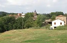
Vazeilles-Limandre (French pronunciation: [vazɛj limɑ̃dʁ]) is a commune in the Haute-Loire department in south-central France in the region Auvergne.
Etymology
Vazeilles-Limandre (Vallilias is meaning " little valley" or "petite vallée" in French) has been known under various names through the centuries.
The distinction between Vazeilles-bas and Vazeilles-haut appeared during the 14th Century.
Vazeilles-bas: Villa inferior de Vazellas (1342); Vazellas inferior (1459); Vaselhas Bassas (1538)
Vazeilles-haut: Villa superior de Vazelhas (1347); Vazehlas Sobeyranas (1457)
Parochia de Vasilis (1470)
Vazaleiz (1511).
Vazeilles on the Map of Cassini (about 1769).
Geography
Vazeilles-Limandre is located at about 20 kilometres northwest of Puy-en-Velay and 30 kilometres southeast of Brioude.
The village is split in two parts, Vazeilles-bas and Vazeilles-haut.
In addition, the commune consists of the hamlets of Beauregard, Fressanges, Limandre, Ninirolles and Sauzet.
History
The discovery of archeological remains in the location of the commune shows a human presence at this time.
The first written documents doing reference to Vazeilles are the archives of Brioude in 969. They present Vazeilles as a "villa" depending on the vicar area of Saint-Paulien.
Population
| Year | Pop. | ±% p.a. |
|---|---|---|
| 1968 | 263 | — |
| 1975 | 259 | −0.22% |
| 1982 | 224 | −2.05% |
| 1990 | 202 | −1.28% |
| 1999 | 211 | +0.49% |
| 2009 | 235 | +1.08% |
| 2014 | 254 | +1.57% |
| 2020 | 266 | +0.77% |
| Source: INSEE[3] | ||
See also
References
- ↑ "Répertoire national des élus: les maires". data.gouv.fr, Plateforme ouverte des données publiques françaises (in French). 2 December 2020.
- ↑ "Populations légales 2021". The National Institute of Statistics and Economic Studies. 28 December 2023.
- ↑ Population en historique depuis 1968, INSEE