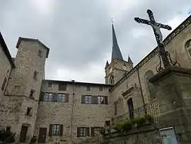
Saint-Pal-de-Chalencon | |
|---|---|
Commune | |
 | |
 Coat of arms | |
Location of Saint-Pal-de-Chalencon | |
 Saint-Pal-de-Chalencon 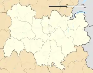 Saint-Pal-de-Chalencon | |
| Coordinates: 45°21′27″N 3°57′27″E / 45.3575°N 3.9575°E | |
| Country | France |
| Region | Auvergne-Rhône-Alpes |
| Department | Haute-Loire |
| Arrondissement | Yssingeaux |
| Canton | Plateau du Haut-Velay granitique |
| Government | |
| • Mayor (2020–2026) | Pierre Brun[1] |
| Area 1 | 28.95 km2 (11.18 sq mi) |
| Population | 1,002 |
| • Density | 35/km2 (90/sq mi) |
| Time zone | UTC+01:00 (CET) |
| • Summer (DST) | UTC+02:00 (CEST) |
| INSEE/Postal code | 43212 /43500 |
| Elevation | 700–978 m (2,297–3,209 ft) (avg. 878 m or 2,881 ft) |
| 1 French Land Register data, which excludes lakes, ponds, glaciers > 1 km2 (0.386 sq mi or 247 acres) and river estuaries. | |
Saint-Pal-de-Chalencon (French pronunciation: [sɛ̃ pal də ʃalɑ̃kɔ̃]) is a commune in the Haute-Loire department in south-central France.[3]
Population
| Year | Pop. | ±% p.a. |
|---|---|---|
| 1968 | 1,206 | — |
| 1975 | 1,039 | −2.11% |
| 1982 | 1,043 | +0.05% |
| 1990 | 1,029 | −0.17% |
| 1999 | 1,046 | +0.18% |
| 2009 | 1,014 | −0.31% |
| 2014 | 1,016 | +0.04% |
| 2020 | 1,004 | −0.20% |
| Source: INSEE[4] | ||
See also
References
- ↑ "Répertoire national des élus: les maires". data.gouv.fr, Plateforme ouverte des données publiques françaises (in French). 2 December 2020.
- ↑ "Populations légales 2021". The National Institute of Statistics and Economic Studies. 28 December 2023.
- ↑ INSEE commune file
- ↑ Population en historique depuis 1968, INSEE
Wikimedia Commons has media related to Saint-Pal-de-Chalencon.
This article is issued from Wikipedia. The text is licensed under Creative Commons - Attribution - Sharealike. Additional terms may apply for the media files.