Sus | |
|---|---|
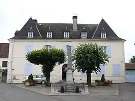 The town hall and school | |
Location of Sus | |
 Sus 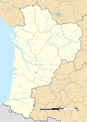 Sus | |
| Coordinates: 43°18′26″N 0°45′55″W / 43.3072°N 0.7653°W | |
| Country | France |
| Region | Nouvelle-Aquitaine |
| Department | Pyrénées-Atlantiques |
| Arrondissement | Oloron-Sainte-Marie |
| Canton | Le Cœur de Béarn |
| Intercommunality | Béarn des Gaves |
| Government | |
| • Mayor (2020–2026) | Jean-Paul Lendre[1] |
| Area 1 | 11.50 km2 (4.44 sq mi) |
| Population | 379 |
| • Density | 33/km2 (85/sq mi) |
| Time zone | UTC+01:00 (CET) |
| • Summer (DST) | UTC+02:00 (CEST) |
| INSEE/Postal code | 64529 /64190 |
| Elevation | 118–263 m (387–863 ft) (avg. 164 m or 538 ft) |
| 1 French Land Register data, which excludes lakes, ponds, glaciers > 1 km2 (0.386 sq mi or 247 acres) and river estuaries. | |
Sus (French pronunciation: [sys]; Basque: Xütxe) is a commune in the Pyrénées-Atlantiques department and Nouvelle-Aquitaine region of south-western France. The town is located near Susmiou, Gurs and Navarrenx. The population was 377 as of 2019.[3]
Geography
Sus is in the Oloron-Sainte-Marie arrondissement in the southern part of Nouvelle-Aquitaine. Sus is 1.4 km (0.9 mi) from Susmiou, 1.8 km (1.1 mi) from Navarrenx, 2.5 km (1.6 mi) from Gurs, 13.2 km (8.2 mi) from Mourenx, 32.1 km (19.9 mi) from Pau, and 60.8 km (37.8 mi) from Bayonne. It sits west of the Gave d'Oloron river. On the opposite side of the river is Jasses.
See also
References
- ↑ "Répertoire national des élus: les maires" (in French). data.gouv.fr, Plateforme ouverte des données publiques françaises. 13 September 2022.
- ↑ "Populations légales 2021". The National Institute of Statistics and Economic Studies. 28 December 2023.
- ↑ Populations légales 2019: 64 Pyrénées-Atlantiques, INSEE
Wikimedia Commons has media related to Sus (Pyrénées-Atlantiques).
This article is issued from Wikipedia. The text is licensed under Creative Commons - Attribution - Sharealike. Additional terms may apply for the media files.