Shahrud County
Persian: شهرستان شاهرود | |
|---|---|
County | |
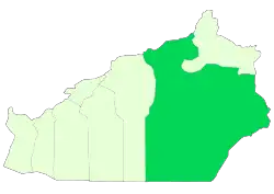 Location of Shahrud County in Semnan province | |
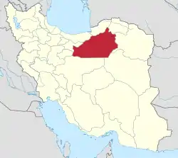 Location of Semnan province in Iran | |
| Coordinates: 35°34′58″N 55°47′44″E / 35.58278°N 55.79556°E[1] | |
| Country | |
| Province | Semnan |
| Capital | Shahrud |
| Districts | Central, Bastam, Beyarjomand |
| Population (2016)[2] | |
| • Total | 218,628 |
| Time zone | UTC+3:30 (IRST) |
| Shahrud County can be found at GEOnet Names Server, at this link, by opening the Advanced Search box, entering "9206417" in the "Unique Feature Id" form, and clicking on "Search Database". | |
Shahrud County (Persian: شهرستان شاهرود) is in Semnan province, Iran. Its capital is the city of Shahrud.[3]
At the 2006 census, the county's population was 225,007 in 62,196 households.[4] The following census in 2011 counted 238,830 people in 70,598 households.[5] At the 2016 census, the county's population was 218,628 in 69,723 households,[2] by which time Meyami District had been separated from the county in the establishment of Meyami County.[6]
Administrative divisions
The population history and structural changes of Shahrud County's administrative divisions over three consecutive censuses are shown in the following table. The latest census shows three districts, seven rural districts, and six cities.[2]
| Administrative Divisions | 2006[4] | 2011[5] | 2016[2] |
|---|---|---|---|
| Central District | 142,663 | 155,326 | 166,963 |
| Dehmolla RD | 2,197 | 1,797 | 2,317 |
| Howmeh RD | 10,008 | 9,555 | 7,366 |
| Torud RD | 3,542 | 3,500 | 3,381 |
| Rudiyan (city) | 3,770 | ||
| Shahrud (city) | 126,916 | 140,474 | 150,129 |
| Bastam District | 37,635 | 39,101 | 44,052 |
| Kalat-e Hay-ye Gharbi RD | 3,456 | 4,568 | 4,983 |
| Kharqan RD | 15,936 | 16,308 | 18,877 |
| Bastam (city) | 7,382 | 7,712 | 8,609 |
| Kalateh-ye Khij (city) | 5,335 | 5,057 | 5,651 |
| Mojen (city) | 5,526 | 5,456 | 5,932 |
| Beyarjomand District | 7,885 | 7,145 | 7,613 |
| Beyarjomand RD | 2,023 | 1,643 | 2,018 |
| Kharturan RD | 3,616 | 3,061 | 3,067 |
| Beyarjomand (city) | 2,246 | 2,441 | 2,528 |
| Meyami District1 | 36,824 | 37,258 | |
| Farumad RD | 3,472 | 2,575 | |
| Kalat-e Hay-ye Sharqi RD | 6,420 | 5,837 | |
| Meyami RD | 6,524 | 5,358 | |
| Nardin RD | 5,514 | 6,630 | |
| Rezvan RD | 10,837 | 12,296 | |
| Meyami (city) | 4,057 | 4,562 | |
| Total | 225,007 | 238,830 | 218,628 |
| RD: Rural District 1Became a part of Meyami County[6] | |||
Notable natives and residents
- Bayazid Bastami, 9th century Sufi
- Abu al-Hassan al-Kharaqani (963-1033), Sufi
- Abbas Foroughi Bastami (1798-1857), poet
Wikimedia Commons has media related to Shahrud County.
References
- ↑ OpenStreetMap contributors (25 April 2023). "Shahrud County" (Map). OpenStreetMap. Retrieved 25 April 2023.
- 1 2 3 4 "Census of the Islamic Republic of Iran, 1395 (2016)". AMAR (in Persian). The Statistical Center of Iran. p. 20. Archived from the original (Excel) on 17 November 2020. Retrieved 19 December 2022.
- ↑ Habibi, Hassan (21 June 1369). "Approval of the organization and chain of citizenship of the elements and units of the national divisions of Semnan province, centered in Semnan city". Lamtakam (in Persian). Ministry of Interior, Defense Political Commission of the Government Council. Archived from the original on 2 January 2024. Retrieved 2 January 2024.
- 1 2 "Census of the Islamic Republic of Iran, 1385 (2006)". AMAR (in Persian). The Statistical Center of Iran. p. 20. Archived from the original (Excel) on 20 September 2011. Retrieved 25 September 2022.
- 1 2 "Census of the Islamic Republic of Iran, 1390 (2011)". Syracuse University (in Persian). The Statistical Center of Iran. p. 20. Archived from the original (Excel) on 20 January 2023. Retrieved 19 December 2022.
- 1 2 Rahimi, Mohammadreza (2 June 2013). "Letter of approval regarding country divisions in Semnan province". Islamic Parliament Research Council (in Persian). Ministry of Interior, Board of Ministers. Archived from the original on 25 September 2011. Retrieved 22 November 2023.
Semnan Province, Iran | |||||||||||||||||
|---|---|---|---|---|---|---|---|---|---|---|---|---|---|---|---|---|---|
| Capital |  | ||||||||||||||||
| Counties and cities |
| ||||||||||||||||
| Sights |
| ||||||||||||||||
| populated places | |||||||||||||||||
This article is issued from Wikipedia. The text is licensed under Creative Commons - Attribution - Sharealike. Additional terms may apply for the media files.