Shahriar County
Persian: شهرستان شهریار | |
|---|---|
County | |
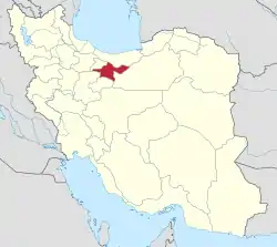
.svg.png.webp) Location of Shahriar County in Tehran province | |
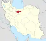
 Location of Tehran province in Iran | |
| Coordinates: 35°36′N 51°05′E / 35.600°N 51.083°E | |
| Country | |
| Province | Tehran |
| Capital | Shahriar |
| Districts | Central |
| Area | |
| • Total | 335.9 km2 (129.7 sq mi) |
| Population (2016) | |
| • Total | 744,210 |
| • Density | 2,200/km2 (5,700/sq mi) |
| Time zone | UTC+3:30 (IRST) |
Shahriar County (Persian: شهرستان شهریار) is in Tehran province, Iran. Its capital is the city of Shahriar.[1]
At the 2006 census, the county's population was 1,044,707 in 273,826 households.[2] The following census in 2011 counted 624,440 people in 178,792 households,[3] by which time Malard District and Qods District had been separated from the county in the establishment of Malard County and Qods County, respectively.[4] At the 2016 census, the county's population was 744,210 in 226,011 households.[5]
Administrative divisions
The population history and structural changes of Shahriar County's administrative divisions over three consecutive censuses are shown in the following table. The latest census shows one district, six rural districts, and seven cities.[5]
| Administrative Divisions | 2006[2] | 2011[3] | 2016[5] |
|---|---|---|---|
| Central District | 516,022 | 624,440 | 744,206 |
| Ferdows RD | 15,225 | 8,041 | 12,003 |
| Juqin RD | 22,587 | 23,075 | 21,540 |
| Maviz RD | 6,199 | 6,291 | 5,782 |
| Qaemabad RD | 30,682 | 3,900 | 3,386 |
| Razakan RD | 25,395 | 26,420 | 26,004 |
| Saidabad RD | 16,176 | 17,671 | 18,903 |
| Andisheh (city) | 75,596 | 96,807 | 116,062 |
| Baghestan (city) | 52,330 | 71,861 | 83,934 |
| Ferdowsieh (city) | 20,854 | 24,508 | 34,221 |
| Sabashahr (city) | 18,132 | 47,123 | 53,971 |
| Shahedshahr (city) | 18,855 | 20,865 | 25,544 |
| Shahriar (city) | 189,120 | 249,473 | 309,607 |
| Vahidieh (city) | 24,871 | 28,405 | 33,249 |
| Malard District1 | 291,608 | ||
| Akhtarabad RD | 3,598 | ||
| Bibi Sakineh RD | 16,003 | ||
| Malard RD | 27,479 | ||
| Malard (city) | 228,673 | ||
| Safadasht (city) | 15,855 | ||
| Qods District2 | 237,077 | ||
| Danesh RD | 4,799 | ||
| Haft Juy RD | 2,924 | ||
| Qods (city) | 229,354 | ||
| Total | 1,044,707 | 624,440 | 744,210 |
| RD: Rural District 1Became a part of Malard County[4] 2Became a part of Qods County[4] | |||
Wikimedia Commons has media related to Shahriar County.
References
- ↑ Habibi, Hassan (21 June 1369). "Approval of the organization and chain of citizenship of the elements and units of the national divisions of Tehran province centered on the city of Tehran". Islamic Parliament Research Center (in Persian). Ministry of Interior, Political-Defense Commission of the Government Board. Archived from the original on 30 November 2014. Retrieved 16 December 2023.
- 1 2 "Census of the Islamic Republic of Iran, 1385 (2006)". AMAR (in Persian). The Statistical Center of Iran. p. 23. Archived from the original (Excel) on 20 September 2011. Retrieved 25 September 2022.
- 1 2 "Census of the Islamic Republic of Iran, 1390 (2011)". Syracuse University (in Persian). The Statistical Center of Iran. p. 23. Archived from the original (Excel) on 20 January 2023. Retrieved 19 December 2022.
- 1 2 3 Davodi, Parviz (22 April 2009). "The government's agreement with 18 changes in country divisions: Three counties were added to the geographical map of the country". DOLAT (in Persian). Ministry of Interior, Board of Ministers. Archived from the original on 5 February 2018. Retrieved 22 November 2023.
- 1 2 3 "Census of the Islamic Republic of Iran, 1395 (2016)". AMAR (in Persian). The Statistical Center of Iran. p. 23. Archived from the original (Excel) on 12 December 2021. Retrieved 19 December 2022.
This article is issued from Wikipedia. The text is licensed under Creative Commons - Attribution - Sharealike. Additional terms may apply for the media files.