Serre-Nerpol | |
|---|---|
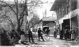 Serre-Nerpol in 1896 | |
 Coat of arms | |
Location of Serre-Nerpol | |
 Serre-Nerpol 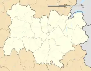 Serre-Nerpol | |
| Coordinates: 45°15′32″N 5°22′33″E / 45.2589°N 5.3758°E | |
| Country | France |
| Region | Auvergne-Rhône-Alpes |
| Department | Isère |
| Arrondissement | Grenoble |
| Canton | Le Sud Grésivaudan |
| Government | |
| • Mayor (2020–2026) | Alain Rousset[1] |
| Area 1 | 13.16 km2 (5.08 sq mi) |
| Population | 311 |
| • Density | 24/km2 (61/sq mi) |
| Time zone | UTC+01:00 (CET) |
| • Summer (DST) | UTC+02:00 (CEST) |
| INSEE/Postal code | 38275 /38470 |
| Elevation | 340–720 m (1,120–2,360 ft) (avg. 400 m or 1,300 ft) |
| 1 French Land Register data, which excludes lakes, ponds, glaciers > 1 km2 (0.386 sq mi or 247 acres) and river estuaries. | |
Serre-Nerpol (French pronunciation: [sɛʁ nɛʁpɔl]) is a commune in the Isère department in southeastern France.[3]
Population
| Year | Pop. | ±% p.a. |
|---|---|---|
| 1968 | 266 | — |
| 1975 | 229 | −2.12% |
| 1982 | 252 | +1.38% |
| 1990 | 269 | +0.82% |
| 1999 | 284 | +0.60% |
| 2009 | 293 | +0.31% |
| 2014 | 293 | +0.00% |
| 2020 | 310 | +0.94% |
| Source: INSEE[4] | ||
See also
References
- ↑ "Répertoire national des élus: les maires". data.gouv.fr, Plateforme ouverte des données publiques françaises (in French). 2 December 2020.
- ↑ "Populations légales 2021". The National Institute of Statistics and Economic Studies. 28 December 2023.
- ↑ INSEE commune file
- ↑ Population en historique depuis 1968, INSEE
Wikimedia Commons has media related to Serre-Nerpol.
This article is issued from Wikipedia. The text is licensed under Creative Commons - Attribution - Sharealike. Additional terms may apply for the media files.