Pasuruan Regency
Kabupaten Pasuruan | |
|---|---|
| Pasuruan | |
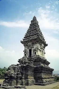 Candi Jawi in Prigen | |
 Coat of arms | |
| Motto(s): Guna Karya Sarana Bhakti (Worthwhile works for the means of service) | |
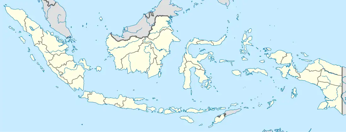
 Location within East Java | |
| Coordinates: 7°44′00″S 112°50′00″E / 7.73333°S 112.83333°E | |
| Country | Indonesia |
| Province | East Java |
| Capital city | Bangil |
| Government | |
| • Regent | H. M. Irsyad Yusuf, S.E, M.M.A. |
| • Vice Regent | KH. Abdul Mujib Imron, S.Pd |
| Area | |
| • Total | 1,474.02 km2 (569.12 sq mi) |
| Population (mid 2022 estimate[1]) | |
| • Total | 1,619,035 |
| • Density | 1,100/km2 (2,800/sq mi) |
| Time zone | UTC+7 (IWST) |
| Area code | (+62) 343 |
| Vehicle registration | N |
| Website | pasuruankab.go.id |

.jpg.webp)
Pasuruan Regency (Indonesian: Kabupaten Pasuruan) is a regency in East Java, province of Indonesia. The capital of this regency is Bangil. The regency covers an area of 1,474.02 km2, and it had a population of 1,512,468 at the 2010 Census[2] and 1,605,969 at the 2020 Census;[3] the official estimate as at mid 2022 was 1,619,035 (comprising 809,968 males and 809,067 females).[1] These figures excludes the population of the city of Pasuruan, which lies geographically within this regency but is administratively separate from it. At present, there are moves under way to make Bangil the new administrative centre of Pasuruan Regency, with some offices being transferred from Pasuruan city to Bangil.[4]
The Dutch spelling of the name of the regency was 'Pasoeroean'.
Administrative districts
Pasuruan Regency is divided into 24 districts (kecamatan), tabulated below with their areas and population totals from the 2010 Census[2] and the 2020 Census,[3] together with the official estimates as at mid 2022.[1] The table also includes the locations of the district administrative centres, the number of administrative villages in each district (totaling 341 rural desa and 24 urban kelurahan), and its postal codes.
| Kode Wilayah | Name of District (kecamatan) | Area in km2 | Pop'n Census 2010 | Pop'n Census 2020 | Pop'n Estimate mid 2022 | Admin centre | No. of villages | Post codes |
|---|---|---|---|---|---|---|---|---|
| 35.14.01 | Purwodadi | 102.46 | 65,363 | 70,015 | 70,601 | Purwodadi | 13 | 67163 |
| 35.14.02 | Tutur | 86.30 | 51,941 | 53,743 | 53,830 | Wonosari | 12 | 67165 |
| 35.14.03 | Puspo | 58.35 | 27,040 | 27,722 | 27,778 | Puspo | 7 | 67176 |
| 35.14.24 | Tosari | 98.00 | 18,478 | 18,799 | 18,837 | Tosari | 8 | 67177 |
| 35.14.04 | Lumbang | 125.55 | 32,856 | 35,174 | 35,464 | Cukurguling | 12 | 67183 |
| 35.14.05 | Pasrepan | 89.95 | 50,070 | 52,396 | 52,596 | Pasrepan | 17 | 67175 |
| 35.14.06 | Kejayan | 79.15 | 62,641 | 65,374 | 65,589 | Kejayan | 25 (a) | 67172 |
| 35.14.07 | Wonorejo | 47.30 | 56,264 | 59,864 | 60,286 | Wonorejo | 15 | 67173 |
| 35.14.08 | Purwosari | 59.67 | 77,871 | 84,137 | 84,962 | Purwosari | 15 (a) | 67162 |
| 35.14.10 | Prigen | 121.90 | 82,429 | 87,227 | 87,745 | Prigen | 14 (b) | 67157 |
| 35.14.09 | Sukorejo | 58.18 | 81,060 | 87,477 | 88,336 | Glagahsari | 19 | 67161 |
| 35.14.11 | Pandaan | 43.27 | 105,326 | 111,062 | 111,651 | Petungsari | 18 (c) | 67156 |
| 35.14.12 | Gempol | 64.92 | 123,084 | 129,990 | 130,719 | Karangrejo | 15 | 67155 |
| 35.14.13 | Beji | 39.90 | 78,269 | 87,022 | 88,385 | Beji | 14 (d) | 67153 |
| 35.14.14 | Bangil | 44.60 | 84,438 | 83,307 | 83,724 | Kolursari | 15 (e) | 67153 |
| 35.14.15 | Rembang | 42.52 | 60,576 | 66,711 | 67,631 | Rembang | 17 | 67152 |
| 35.14.16 | Kraton | 50.75 | 89,128 | 88,525 | 88,969 | Kraton | 25 | 67151 |
| 35.14.17 | Pohjentrek | 11.88 | 28,308 | 31,296 | 31,751 | Susukanrejo | 9 | 67171 |
| 35.14.18 | Gondangwetan | 26.25 | 50,612 | 56,264 | 56,705 | Gondangwetan | 20 (a) | 67174 |
| 35.14.23 | Rejoso | 37.00 | 43,779 | 46,766 | 47,132 | Rejoso Lor | 16 | 67181 |
| 35.14.19 | Winongan | 45.97 | 41,206 | 44,287 | 44,686 | Winongan Lor | 18 | 67182 |
| 35.14.20 | Grati | 50.78 | 70,963 | 78,930 | 79,512 | Gratitunon | 15 (a) | 67184 |
| 25.14.22 | Lekok | 46.57 | 70,531 | 77,514 | 78,551 | Tambaklekok | 11 | 67186 |
| 35.14.21 | Nguling | 42.60 | 54,957 | 62,367 | 63,595 | Nguling | 15 | 67185 |
| Totals | 1,474.02 | 1,512,468 | 1,605,969 | 1,619,035 | Bangil | 365 |
Notes: (a) includes one kelurahan (the administrative centre). (b) including 3 kelurahan (Ledug, Pecalukan and Prigen).
(c) including 5 kelurahan (Banjarsari, Jogosari, Kutorejo, Pandaan and Petungasri). (d) including 2 kelurahan (Glanggang and Pagak).
(e) comprising 11 kelurahan (Bendo Mungal, Dermo, Gempeng, Kalianyar, Kalirejo, Kauman, Kersikan, Kidul Dalem, Kolursari, Latek and Pogar) and 4 desa.