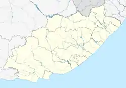
Mpofu | |
|---|---|
 Mpofu  Mpofu | |
| Coordinates: 32°20′24″S 26°47′31″E / 32.340°S 26.792°E | |
| Country | South Africa |
| Province | Eastern Cape |
| District | Chris Hani |
| Municipality | Enoch Mgijima |
| Area | |
| • Total | 1.73 km2 (0.67 sq mi) |
| Population (2001)[1] | |
| • Total | 171 |
| • Density | 99/km2 (260/sq mi) |
| Time zone | UTC+2 (SAST) |
Mpofu is a town in Chris Hani District Municipality in the Eastern Cape province of South Africa.
As of 1996, it was the seat of a magisterial district.[2]
References
- 1 2 "Sub Place Mpofu". Census 2001.
- ↑ "Magisterial District List". Statistics South Africa. Archived from the original on 24 August 2007. Retrieved 18 August 2013.
This article is issued from Wikipedia. The text is licensed under Creative Commons - Attribution - Sharealike. Additional terms may apply for the media files.
.svg.png.webp)