Labaroche | |
|---|---|
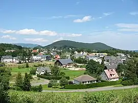 A general view of Labaroche | |
.svg.png.webp) Coat of arms | |
Location of Labaroche | |
 Labaroche 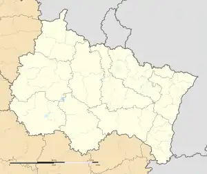 Labaroche | |
| Coordinates: 48°06′38″N 7°11′38″E / 48.1106°N 7.1939°E | |
| Country | France |
| Region | Grand Est |
| Department | Haut-Rhin |
| Arrondissement | Colmar-Ribeauvillé |
| Canton | Sainte-Marie-aux-Mines |
| Intercommunality | Vallée de Kaysersberg |
| Government | |
| • Mayor (2020–2026) | Bernard Ruffio[1] |
| Area 1 | 13.44 km2 (5.19 sq mi) |
| Population | 2,116 |
| • Density | 160/km2 (410/sq mi) |
| Time zone | UTC+01:00 (CET) |
| • Summer (DST) | UTC+02:00 (CEST) |
| INSEE/Postal code | 68173 /68910 |
| Elevation | 420–980 m (1,380–3,220 ft) (avg. 750 m or 2,460 ft) |
| 1 French Land Register data, which excludes lakes, ponds, glaciers > 1 km2 (0.386 sq mi or 247 acres) and river estuaries. | |
Labaroche (French pronunciation: [labaʁɔʃ] ⓘ; German: Zell) is a commune in the Haut-Rhin department in Grand Est in north-eastern France.
It is located in the Vosges mountains at an average altitude of 750 m. There is a post-office, a bank, several hotels, a little super-market, a salon de thé, 2 boulangeries, and a museum, Le Musée des métiers du bois. To the south of the village, on top of a mountain called Petit Hohnack, stands the ruin of a medieval castle.
Population
| Year | Pop. | ±% p.a. |
|---|---|---|
| 1968 | 1,157 | — |
| 1975 | 1,204 | +0.57% |
| 1982 | 1,483 | +3.02% |
| 1990 | 1,676 | +1.54% |
| 1999 | 1,985 | +1.90% |
| 2007 | 2,202 | +1.31% |
| 2012 | 2,244 | +0.38% |
| 2017 | 2,165 | −0.71% |
| Source: INSEE[3] | ||
See also
References
- ↑ "Répertoire national des élus: les maires" (in French). data.gouv.fr, Plateforme ouverte des données publiques françaises. 13 September 2022.
- ↑ "Populations légales 2021". The National Institute of Statistics and Economic Studies. 28 December 2023.
- ↑ Population en historique depuis 1968, INSEE
External links
Wikimedia Commons has media related to Labaroche.
This article is issued from Wikipedia. The text is licensed under Creative Commons - Attribution - Sharealike. Additional terms may apply for the media files.