Carpineto | |
|---|---|
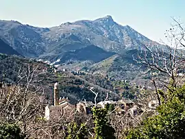 Castagniccia village in Carpineto, with Carcheto and Monte San Petrone in the background | |
Location of Carpineto | |
 Carpineto 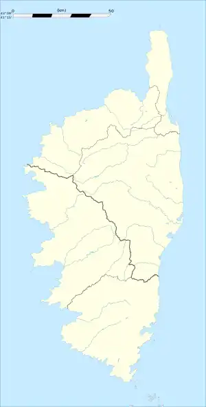 Carpineto | |
| Coordinates: 42°21′21″N 9°22′49″E / 42.3558°N 9.3803°E | |
| Country | France |
| Region | Corsica |
| Department | Haute-Corse |
| Arrondissement | Corte |
| Canton | Castagniccia |
| Government | |
| • Mayor (2020–2026) | Marcel Ferrari[1] |
| Area 1 | 2.44 km2 (0.94 sq mi) |
| Population | 35 |
| • Density | 14/km2 (37/sq mi) |
| Time zone | UTC+01:00 (CET) |
| • Summer (DST) | UTC+02:00 (CEST) |
| INSEE/Postal code | 2B067 /20229 |
| Elevation | 477–922 m (1,565–3,025 ft) (avg. 700 m or 2,300 ft) |
| 1 French Land Register data, which excludes lakes, ponds, glaciers > 1 km2 (0.386 sq mi or 247 acres) and river estuaries. | |
Carpineto is a commune in the Haute-Corse department of France on the island of Corsica.
Population
| Year | Pop. | ±% |
|---|---|---|
| 1962 | 51 | — |
| 1968 | 71 | +39.2% |
| 1975 | 36 | −49.3% |
| 1982 | 29 | −19.4% |
| 1990 | 15 | −48.3% |
| 1999 | 11 | −26.7% |
| 2008 | 26 | +136.4% |
See also
References
- ↑ "Répertoire national des élus: les maires". data.gouv.fr, Plateforme ouverte des données publiques françaises (in French). 2 December 2020.
- ↑ "Populations légales 2020". The National Institute of Statistics and Economic Studies. 29 December 2022.
External links
![]() Media related to Carpineto at Wikimedia Commons
Media related to Carpineto at Wikimedia Commons
This article is issued from Wikipedia. The text is licensed under Creative Commons - Attribution - Sharealike. Additional terms may apply for the media files.