Beaumesnil | |
|---|---|
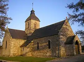 The church in Beaumesnil | |
Location of Beaumesnil | |
 Beaumesnil 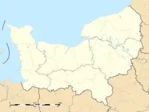 Beaumesnil | |
| Coordinates: 48°53′39″N 0°58′57″W / 48.8942°N 0.9825°W | |
| Country | France |
| Region | Normandy |
| Department | Calvados |
| Arrondissement | Vire |
| Canton | Vire Normandie |
| Intercommunality | Intercom de la Vire au Noireau |
| Government | |
| • Mayor (2020–2026) | Gilles Porquet[1] |
| Area 1 | 4.99 km2 (1.93 sq mi) |
| Population | 205 |
| • Density | 41/km2 (110/sq mi) |
| Time zone | UTC+01:00 (CET) |
| • Summer (DST) | UTC+02:00 (CEST) |
| INSEE/Postal code | 14054 /14380 |
| Elevation | 72–153 m (236–502 ft) (avg. 133 m or 436 ft) |
| 1 French Land Register data, which excludes lakes, ponds, glaciers > 1 km2 (0.386 sq mi or 247 acres) and river estuaries. | |
Beaumesnil (French pronunciation: [bomenil] ⓘ) is a commune in the Calvados department in the Normandy region in northwestern France.
Geography
The village is centred on a staggered crossroads between the D52 which heads to Pont-Farcy to the north and Vire to the south and the D81 which leads to Le Beny-Bocage to the north east and Landelles-et-Coupigny to the south west.
Population
| Year | Pop. | ±% |
|---|---|---|
| 1962 | 211 | — |
| 1968 | 201 | −4.7% |
| 1975 | 194 | −3.5% |
| 1982 | 152 | −21.6% |
| 1990 | 177 | +16.4% |
| 1999 | 188 | +6.2% |
| 2008 | 199 | +5.9% |
See also
References
- ↑ "Répertoire national des élus: les maires". data.gouv.fr, Plateforme ouverte des données publiques françaises (in French). 2 December 2020.
- ↑ "Populations légales 2021". The National Institute of Statistics and Economic Studies. 28 December 2023.
Wikimedia Commons has media related to Beaumesnil (Calvados).
This article is issued from Wikipedia. The text is licensed under Creative Commons - Attribution - Sharealike. Additional terms may apply for the media files.