| Coordinates | 77°50′10″N 14°14′16″E / 77.8361°N 14.2378°E |
|---|
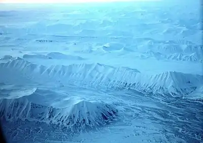
Ytterdalen with Skarkampen and Ytterdalssåta to the left, and Ytterdalsegga and Fridtjovbreen in the background
Ytterdalen ("The outer valley") is a valley in Nordenskiöld Land at Spitsbergen, Svalbard. It has a length of about nine kilometers, and is located between the mountains of Flynibba, Grånutane, Ytterdalsegga, Ytterdalssåta, Skarkampen and Salen.[1] The river of Ytterdalselva from the glacier of Erdmannbreen flows through the valley, and further crosses Lågnesflya on its way to the bay of Van Muydenbukta.[2]
References
- ↑ "Ytterdalen (Svalbard)". Norwegian Polar Institute. Retrieved 2 May 2014.
- ↑ "Ytterdalselva (Svalbard)". Norwegian Polar Institute. Retrieved 2 May 2014.
This article is issued from Wikipedia. The text is licensed under Creative Commons - Attribution - Sharealike. Additional terms may apply for the media files.