| Wheathill | |
|---|---|
 | |
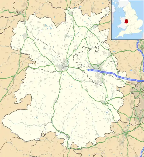 Wheathill Location within Shropshire | |
| Area | 12.00 km2 (4.63 sq mi) |
| Population | 229 (2011 census) |
| • Density | 19/km2 (49/sq mi) |
| Civil parish |
|
| Unitary authority | |
| Shire county | |
| Region | |
| Country | England |
| Sovereign state | United Kingdom |
| Website | http://wheathillparishcouncil.org.uk/ |
Wheathill is a village and civil parish 21 miles (34 km) south east of Shrewsbury,[1] in the Shropshire district, in the ceremonial county of Shropshire, England. The parish includes the villages of Loughton and Silvington, the hamlet of Bromdon and the deserted village of Egerton.[2] In 2011 the parish had a population of 229.[3] The parish touches Aston Botterell, Bitterley, Burwarton, Clee St. Margaret, Farlow, Hopton Wafers and Stoke St. Milborough.[4]
Landmarks
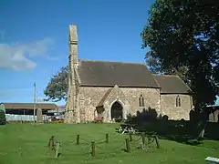
There are 14 listed buildings in Wheathill.[5] Wheathill has a church called Holy Trinity.[6]
History
The name "Wheathill" means 'Wheat hill'.[7] Wheathill was recorded in the Domesday Book as Waltham.[8] On 1 April 1967 Loughton and Silvington parishes were merged with Wheathill.[9]
References
- ↑ "Distance from Wheathill [52.435558, 2.55744]". GENUKI. Retrieved 18 June 2021.
- ↑ Historic England. "Egerton (112910)". Research records (formerly PastScape). Retrieved 18 June 2021.
- ↑ "Wheathill". City Population De. Retrieved 18 June 2021.
- ↑ "Wheathill". Ordnance Survey. Retrieved 18 June 2021.
- ↑ "Listed buildings in Wheathill, Shropshire". British Listed Buildings. Retrieved 18 June 2021.
- ↑ "Wheathill Church". A Church Near You. Retrieved 18 June 2021.
- ↑ "Wheathill Key to English Place-names". The University of Nottingham. Retrieved 18 June 2021.
- ↑ "Shropshire T-Z and Welsh entries". The Domesday Book Online. Retrieved 18 June 2021.
- ↑ "Relationships and changes Wheathill CP/AP through time". A Vision of Britain through Time. Retrieved 18 June 2021.
External links
Wikimedia Commons has media related to Wheathill, Shropshire.
This article is issued from Wikipedia. The text is licensed under Creative Commons - Attribution - Sharealike. Additional terms may apply for the media files.