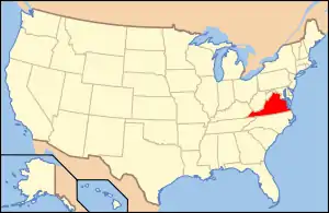
Tazewell Historic District | |
 Tazewell County Courthouse and Civil War Memorial, April 2006 | |
  | |
| Location | Main, Church, Tower, and Pine Sts., Central Ave., and Fincastle Turnpike, Tazewell, Virginia |
|---|---|
| Coordinates | 37°07′03″N 81°31′15″W / 37.11750°N 81.52083°W |
| Built | 1866 |
| Architect | Pierce, William; Bryan, Andrew J. |
| Architectural style | Mid 19th Century Revival, Late Victorian |
| NRHP reference No. | 02000519[1] (original) 16000541 (increase) |
| VLR No. | 158-0005 |
| Significant dates | |
| Added to NRHP | May 16, 2002 |
| Boundary increase | August 15, 2016[2] |
| Designated VLR | December 5, 2001[3] |
Tazewell Historic District is a national historic district located at Tazewell, Tazewell County, Virginia. The district encompasses 112 contributing buildings in central business district and surrounding residential area of the town of Tazewell.
The most notable building is the Tazewell County Courthouse. It was built in 1874, and rebuilt in 1913 in a Classical Revival style. Other notable buildings include the Old Jail (c. 1832), Clinch Valley News Building, Stras Memorial Episcopal Church (1884), Tazewell Christian Church (1898), Clinch Valley Bank (1889), J. A. Greever Building (1914), Greever and Gillespie Law Office Building (1897), Tazewell High School (1931), Tazewell Masonic Lodge #62 (1931), Tazewell Post Office (1936), and Tazewell Presbyterian Church (1924, 1959).[4]
It was listed on the National Register of Historic Places in 2002, and had a boundary increase in 2016.[1][2]
References
- 1 2 "National Register Information System". National Register of Historic Places. National Park Service. July 9, 2010.
- 1 2 "National Register of Historic Places Listings". Weekly List of Actions Taken on Properties: 8/15/16 THROUGH 8/19/16. National Park Service. August 26, 2016.
- ↑ "Virginia Landmarks Register". Virginia Department of Historic Resources. Retrieved June 5, 2013.
- ↑ Gibson Worsham (February 2001). "National Register of Historic Places Inventory/Nomination: Tazewell Historic District" (PDF). Virginia Department of Historic Resources. and Accompanying two photos and Accompanying map

