Sutherland, Virginia | |
|---|---|
Unincorporated community | |
 Sutherland  Sutherland | |
| Coordinates: 37°11′46″N 77°33′35″W / 37.19611°N 77.55972°W | |
| Country | United States |
| State | Virginia |
| County | Dinwiddie |
| Elevation | 289 ft (88 m) |
| Time zone | UTC−5 (Eastern (EST)) |
| • Summer (DST) | UTC−4 (EDT) |
| ZIP code | 23885[1] |
| Area code | 804 |
| GNIS feature ID | 1500198[2] |
Sutherland is an unincorporated community in Dinwiddie County, Virginia, United States. Sutherland is located on U.S. Route 460 9 miles (14 km) west-southwest of Petersburg.
This town was a stop on the Southside Railroad in the mid-nineteenth century. This became the Atlantic, Mississippi and Ohio Railroad in 1870 and then a line in the Norfolk and Western Railway and now the Norfolk Southern Railway.[3] Sutherland was the location of the American Civil War Battle of Sutherland's Station on April 2, 1865 during the Appomattox Campaign.
Mathematician Gladys West was born in Sutherland.[4]
References
- ↑ "Sutherland ZIP Code". zipdatamaps.com. 2022. Retrieved November 11, 2022.
- ↑ U.S. Geological Survey Geographic Names Information System: Sutherland, Virginia
- ↑ Bright, David L. (2015). "Confederate Railroads - South Side". Confederate Railroads. Retrieved January 25, 2018.
- ↑ Kinkade, Daniel (May 3, 2019). "Destination on Right: the Influence of Dr. Gladys West". Gideons International. Retrieved May 29, 2019.
Municipalities and communities of Dinwiddie County, Virginia, United States | ||
|---|---|---|
| Town | 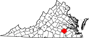 Map of Virginia highlighting Dinwiddie County | |
| CDP | ||
| Other communities | ||
This article is issued from Wikipedia. The text is licensed under Creative Commons - Attribution - Sharealike. Additional terms may apply for the media files.