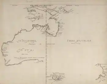
 The island appears on this 1644 map as "I St. Pierre" | |
 St Peter Island | |
| Geography | |
|---|---|
| Location | Great Australian Bight |
| Coordinates | 32°17′S 133°34′E / 32.283°S 133.567°E |
| Archipelago | Nuyts Archipelago |
| Administration | |
Australia | |
St Peter Island (originally in Dutch: Eyland St. Pierre) is an island in the Nuyts Archipelago on the west coast of Eyre Peninsula in South Australia near Ceduna. It is the second largest island in South Australia and about 13 km (8.1 mi) long.[1] It was one of the first parts of South Australia to be discovered and named by Europeans, along with St Francis Island, mapped by François Thijssen in 't Gulden Zeepaert in 1627.
Seal hunting took place on the island in the 1820s and 1830s.[2] Archaeological investigations have also located whale vertebra at the site.
The historic St Peter Island Whaling Sites are listed on the South Australian Heritage Register as a designated place of archaeological significance.[3]
Protected area status
Statutory reserves
The island is part of the Nuyts Archipelago Conservation Park while the waters surrounding its shores are in the Nuyts Archipelago Marine Park.[4][5][6]
Non-statutory arrangements
Important Bird Area
The island is part of the Nuyts Archipelago Important Bird Area (IBA), so identified by BirdLife International because it supports over 1% of the world populations of short-tailed shearwaters, white-faced storm-petrels and pied oystercatchers.[7] The island lies across the Yatala Channel from the separate Tourville and Murat Bays Important Bird Area, just west of Ceduna on the mainland.[8]
See also
Notes
- ↑ "Pieter Nuyts". Flinders Rangers Research. Retrieved 23 July 2008.
- ↑ Kostoglou, Parry; McCarthy, Justin (1991). Whaling and sealing sites in South Australia. Fremantle, WA: Australian Institute for Maritime Archaeology. pp. 47–50.
- ↑ "St Peter Island Whaling Sites, Nuyts Archipelago Conservation Park (designated places of archaeological significance)". South Australian Heritage Register. Department of Environment, Water and Natural Resources. Retrieved 12 February 2016.
- ↑ Wilderness Advisory Committee Annual Report 2012-13 (PDF) (Report). September 2013. pp. 18 & 23. ISSN 1832-9357. Retrieved 17 March 2014.
- ↑ Anon (2006). Island Parks of Western Eyre Peninsula Management Plan (PDF). Adelaide: Department for Environment and Heritage, South Australia. p. 2. ISBN 1-921238-18-6.
- ↑ "NUYTS ARCHIPELAGO MARINE PARK MANAGEMENT PLAN 2012" (PDF). Department of Environment, Water and Natural Resources. p. 5. Retrieved 18 October 2014.
- ↑ "IBA: Nuyts Archipelago". Birdata. Birds Australia. Retrieved 5 September 2011.
- ↑ BirdLife International. (2011). Important Bird Areas factsheet: Tourville and Murat Bays. Downloaded from http://www.birdlife.org on 2011-11-07.