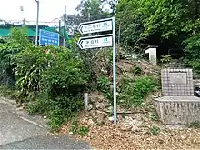
Signs at Sha Tin Pass indicating Shap Yi Wat Village and Mau Tat Village.
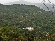
Shap Yi Wat viewed from the slope of Temple Hill.
Shap Yi Wat (Chinese: 十二笏) is a village in Sha Tin District, Hong Kong. It is a recognized village under the New Territories Small House Policy.[1] It had a population of six in 1911.[2]
See also
References
- ↑ "List of Recognized Villages under the New Territories Small House Policy" (PDF). Lands Department. September 2009.
- ↑ Hase, P. H. (2020). "Chapter 3. Traditional Sha Tin". Settlement, Life, and Politics - Understanding the Traditional New Territories. Royal Asiatic Society Hong Kong studies series. City University of Hong Kong Press. p. 225. ISBN 9789629374419.
External links
Wikimedia Commons has media related to Shap Yi Wat.
22°21′27″N 114°11′55″E / 22.357594°N 114.198537°E
This article is issued from Wikipedia. The text is licensed under Creative Commons - Attribution - Sharealike. Additional terms may apply for the media files.