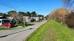
Selwyn Huts | |
|---|---|
Rural settlement | |
 Selwyn Huts in August 2023 | |
| Coordinates: 43°42′58″S 172°26′28″E / 43.716°S 172.441°E | |
| Country | New Zealand |
| Region | Canterbury |
| Territorial authority | Selwyn District |
| Ward | Springs |
| Area | |
| • Total | 0.13 km2 (0.05 sq mi) |
| Elevation | 15 m (49 ft) |
| Population (2018 census)[2] | |
| • Total | 90 |
| • Density | 690/km2 (1,800/sq mi) |
| Time zone | UTC+12 (New Zealand Standard Time) |
| • Summer (DST) | UTC+13 (New Zealand Daylight Time) |
| Area code | 03 |
Selwyn Huts, also called Upper Selwyn Huts, is a rural settlement close to the northern shore of Lake Ellesmere / Te Waihora in the Selwyn District of New Zealand. Lower Selwyn Huts is a smaller settlement 2.8 km further south.[3]
The settlement consists of private dwellings on public land, and has existed since 1895.[4] Residents pay an annual licensing fee for use of the land.[5]
Lower Selwyn Huts was affected by flooding in 2021.[6]
Demographics
Selwyn Huts covers 0.13 km2 (0.050 sq mi).[1] It is part of the Irwell statistical area.[7]
| Year | Pop. | ±% p.a. |
|---|---|---|
| 2006 | 81 | — |
| 2013 | 60 | −4.20% |
| 2018 | 90 | +8.45% |
| Source: [2] | ||
7026938 had a population of 90 at the 2018 New Zealand census, an increase of 30 people (50.0%) since the 2013 census, and an increase of 9 people (11.1%) since the 2006 census. There were 57 households. There were 42 males and 48 females, giving a sex ratio of 0.88 males per female. The median age was 59.0 years (compared with 37.4 years nationally), with 9 people (10.0%) aged under 15 years, 6 (6.7%) aged 15 to 29, 51 (56.7%) aged 30 to 64, and 21 (23.3%) aged 65 or older.
Ethnicities were 93.3% European/Pākehā, 10.0% Māori, and 3.3% Pacific peoples (totals add to more than 100% since people could identify with multiple ethnicities).
Although some people objected to giving their religion, 43.3% had no religion, and 36.7% were Christian.
Of those at least 15 years old, 12 (14.8%) people had a bachelor or higher degree, and 18 (22.2%) people had no formal qualifications. The median income was $22,500, compared with $31,800 nationally. The employment status of those at least 15 was that 39 (48.1%) people were employed full-time, and 9 (11.1%) were part-time.[2]
See also
References
- 1 2 "ArcGIS Web Application". statsnz.maps.arcgis.com. Retrieved 25 October 2021.
- 1 2 3 "Statistical area 1 dataset for 2018 Census". Statistics New Zealand. March 2020. 7026938 (7026938). 2018 Census place summary: 7026938
- ↑ Harriss, Gavin (July 2021). "NZ Topo Map" (Map). Selwyn Huts, Canterbury.
- ↑ Mitchell, Charlie (2 March 2019). "Historic community at Selwyn Huts in climate change limbo". Stuff.
- ↑ Bolger, Devon (31 March 2020). "A 'complete joke': Canterbury community reacts to 70% fee hike". Otago Daily Times.
- ↑ Porter, Nadine (2 June 2021). "Race against time to save tiny Selwyn Huts community bracing for more flooding". Stuff.
- ↑ 2018 Census place summary: Irwell
External links
- Doyleston at the Selwyn District Council