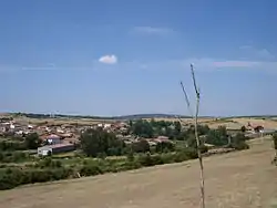
Samir de los Caños | |
|---|---|
 | |
 Flag  Seal | |
| Country | |
| Autonomous community | |
| Province | |
| Municipality | Samir de los Caños |
| Area | |
| • Total | 36 km2 (14 sq mi) |
| Population (2018)[1] | |
| • Total | 180 |
| • Density | 5.0/km2 (13/sq mi) |
| Time zone | UTC+1 (CET) |
| • Summer (DST) | UTC+2 (CEST) |
Samir de los Caños is a municipality in the province of Zamora, Castile and León, Spain. According to the 2004 census (INE), the municipality has a population of 227 inhabitants. As of 2022, Samir de los Caños had 163 inhabitants.[2]
History
With the creation—in 1833—of the current provinces, Samir de los Caños was attached to the Zamora’s, within the Region of León, which, like all Spanish regions of the time, lacked administrative powers.[3] A year later it was integrated into the Judicial District of Alcañices,[4] a fact that lasted until 1983, when it was abolished and integrated into the Judicial District of Zamora.[5] After the 1978 constitution, Samir became part of the autonomous community of Castilla y León in 1983, as a municipality integrated into the province of Zamora.[6]
References
- ↑ Municipal Register of Spain 2018. National Statistics Institute.
- ↑ Instituto Nacional de Estadística de España
- ↑ «Real Decreto de 30 de noviembre de 1833 sobre la división civil de territorio español en la Península e islas adyacentes en 49 provincias». Gaceta de Madrid. 1833.
- ↑ Subdivisión en partidos judiciales de la nueva división territorial de la Península e islas adyacentes / aprobada por S. M. en el real decreto de 21 de abril de 1834
- ↑ Real Decreto 529/1983, de 9 de marzo, por el que se determinan los Partidos Judiciales de cada provincia, a considerar a efectos de las elecciones de Diputados provinciales.
- ↑ Administración del Estado (30 de noviembre de 2007). «Ley Orgánica 14/2007, de 30 de noviembre, de reforma del Estatuto de Autonomía de Castilla y León». Boletín Oficial de Castilla y León, suplemento al núm. 234, de 3 de diciembre de 2007. Madrid: Junta de Castilla y León.