Saint-Sauveur-de-Carrouges | |
|---|---|
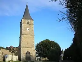 The church in Saint-Sauveur-de-Carrouges | |
Location of Saint-Sauveur-de-Carrouges | |
 Saint-Sauveur-de-Carrouges 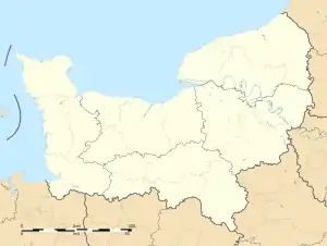 Saint-Sauveur-de-Carrouges | |
| Coordinates: 48°35′12″N 0°06′21″W / 48.5867°N 0.1058°W | |
| Country | France |
| Region | Normandy |
| Department | Orne |
| Arrondissement | Alençon |
| Canton | Magny-le-Désert |
| Government | |
| • Mayor (2020–2026) | Jean-Pierre Trouillot[1] |
| Area 1 | 11.42 km2 (4.41 sq mi) |
| Population | 243 |
| • Density | 21/km2 (55/sq mi) |
| Time zone | UTC+01:00 (CET) |
| • Summer (DST) | UTC+02:00 (CEST) |
| INSEE/Postal code | 61453 /61320 |
| Elevation | 209–356 m (686–1,168 ft) (avg. 325 m or 1,066 ft) |
| 1 French Land Register data, which excludes lakes, ponds, glaciers > 1 km2 (0.386 sq mi or 247 acres) and river estuaries. | |
Saint-Sauveur-de-Carrouges (French pronunciation: [sɛ̃ sovœʁ də kaʁuʒ] ⓘ, literally Saint-Saviour of Carrouges) is a commune in the Orne department in north-western France. As of 2019, the commune had a total population of 252 residents.[3]
Geography
The commune is made up of the following collection of villages and hamlets, L'Être És Pont, Le Fay, Gros Fay, La Druitière, Les Noës, Le Bois Bonnevent, L'Être Logeard, L'Être Mathieu, La Noé, Les Érables and Saint-Sauveur-de-Carrouges.[4]
It is 1,140 hectares (4.4 sq mi) in size. The highest point in the commune is 313 metres (1,027 ft).[5]
The commune is within the Normandie-Maine Regional Natural Park and Forêt d'Écouves.[6][7]
The commune has five streams flowing through it, Grand Pied, Moulin de Besnard, Coupigny, Landelles and the Gue de la Heze.[5]
Neighbouring communes[4] | ||||||||||||||||
|---|---|---|---|---|---|---|---|---|---|---|---|---|---|---|---|---|
| ||||||||||||||||
See also
References
- ↑ "Répertoire national des élus: les maires". data.gouv.fr, Plateforme ouverte des données publiques françaises (in French). 9 August 2021.
- ↑ "Populations légales 2021". The National Institute of Statistics and Economic Studies. 28 December 2023.
- ↑ INSEE commune file
- 1 2 "Saint-Sauveur-de-Carrouges · 61320, France". Saint-Sauveur-de-Carrouges · 61320, France.
- 1 2 "Mairie de Saint-Sauveur-de-Carrouges et sa commune (61320)". Annuaire-Mairie. 26 October 2023.
- ↑ "rapport de charte" (PDF), parc-naturel-normandie-maine.fr/
- ↑ "MASSIF FORESTIER D'ECOUVES ET SES MARGES" (PDF). ZNIEFF.