Saint-Martin-Lestra | |
|---|---|
Commune | |
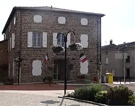 Town hall | |
Location of Saint-Martin-Lestra | |
 Saint-Martin-Lestra 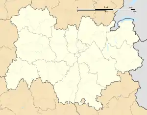 Saint-Martin-Lestra | |
| Coordinates: 45°43′18″N 4°21′19″E / 45.7217°N 4.3553°E | |
| Country | France |
| Region | Auvergne-Rhône-Alpes |
| Department | Loire |
| Arrondissement | Montbrison |
| Canton | Feurs |
| Government | |
| • Mayor (2020–2026) | Yves Grandrieux[1] |
| Area 1 | 16.33 km2 (6.31 sq mi) |
| Population | 910 |
| • Density | 56/km2 (140/sq mi) |
| Time zone | UTC+01:00 (CET) |
| • Summer (DST) | UTC+02:00 (CEST) |
| INSEE/Postal code | 42261 /42110 |
| Elevation | 457–623 m (1,499–2,044 ft) (avg. 590 m or 1,940 ft) |
| 1 French Land Register data, which excludes lakes, ponds, glaciers > 1 km2 (0.386 sq mi or 247 acres) and river estuaries. | |
Saint-Martin-Lestra (French pronunciation: [sɛ̃ maʁtɛ̃ lɛstʁa]) is a commune in the Loire department in central France.[3]
Population
| Year | Pop. | ±% p.a. |
|---|---|---|
| 1968 | 851 | — |
| 1975 | 738 | −2.01% |
| 1982 | 705 | −0.65% |
| 1990 | 604 | −1.91% |
| 1999 | 693 | +1.54% |
| 2009 | 897 | +2.61% |
| 2014 | 892 | −0.11% |
| 2020 | 907 | +0.28% |
| Source: INSEE[4] | ||
See also
References
- ↑ "Répertoire national des élus: les maires". data.gouv.fr, Plateforme ouverte des données publiques françaises (in French). 2 December 2020.
- ↑ "Populations légales 2021". The National Institute of Statistics and Economic Studies. 28 December 2023.
- ↑ INSEE commune file
- ↑ Population en historique depuis 1968, INSEE
Wikimedia Commons has media related to Saint-Martin-Lestra.
This article is issued from Wikipedia. The text is licensed under Creative Commons - Attribution - Sharealike. Additional terms may apply for the media files.