Saint-Marcel | |
|---|---|
_mairie.JPG.webp) The town hall in Saint-Marcel | |
Location of Saint-Marcel | |
 Saint-Marcel 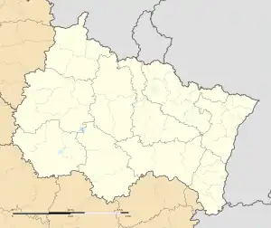 Saint-Marcel | |
| Coordinates: 49°45′49″N 4°34′27″E / 49.7636°N 4.5742°E | |
| Country | France |
| Region | Grand Est |
| Department | Ardennes |
| Arrondissement | Charleville-Mézières |
| Canton | Rocroi |
| Government | |
| • Mayor (2020–2026) | Daniel Thiébaux[1] |
| Area 1 | 10.84 km2 (4.19 sq mi) |
| Population | 318 |
| • Density | 29/km2 (76/sq mi) |
| Time zone | UTC+01:00 (CET) |
| • Summer (DST) | UTC+02:00 (CEST) |
| INSEE/Postal code | 08389 /08460 |
| Elevation | 153–296 m (502–971 ft) (avg. 181 m or 594 ft) |
| 1 French Land Register data, which excludes lakes, ponds, glaciers > 1 km2 (0.386 sq mi or 247 acres) and river estuaries. | |
Saint-Marcel (French pronunciation: [sɛ̃ maʁsɛl] ⓘ) is a commune in the Ardennes department and Grand Est region of north-eastern France.
Population
| Year | Pop. | ±% p.a. |
|---|---|---|
| 1968 | 194 | — |
| 1975 | 180 | −1.06% |
| 1982 | 265 | +5.68% |
| 1990 | 309 | +1.94% |
| 1999 | 325 | +0.56% |
| 2009 | 326 | +0.03% |
| 2014 | 382 | +3.22% |
| 2020 | 327 | −2.56% |
| Source: INSEE[3] | ||
See also
References
- ↑ "Répertoire national des élus: les maires". data.gouv.fr, Plateforme ouverte des données publiques françaises (in French). 2 December 2020.
- ↑ "Populations légales 2021". The National Institute of Statistics and Economic Studies. 28 December 2023.
- ↑ Population en historique depuis 1968, INSEE
Wikimedia Commons has media related to Saint-Marcel, Ardennes.
This article is issued from Wikipedia. The text is licensed under Creative Commons - Attribution - Sharealike. Additional terms may apply for the media files.