Saint-Mélany | |
|---|---|
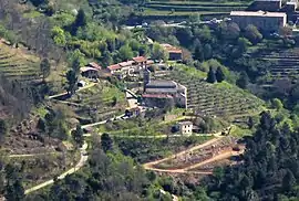 A general view of Saint-Mélany | |
Location of Saint-Mélany | |
 Saint-Mélany 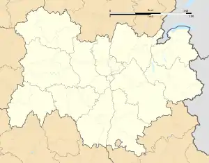 Saint-Mélany | |
| Coordinates: 44°31′51″N 4°07′09″E / 44.5308°N 4.1192°E | |
| Country | France |
| Region | Auvergne-Rhône-Alpes |
| Department | Ardèche |
| Arrondissement | Largentière |
| Canton | Les Cévennes ardéchoises |
| Intercommunality | Pays Beaume Drobie |
| Government | |
| • Mayor (2022–2026) | Didier Piolat[1] |
| Area 1 | 10.64 km2 (4.11 sq mi) |
| Population | 96 |
| • Density | 9.0/km2 (23/sq mi) |
| Time zone | UTC+01:00 (CET) |
| • Summer (DST) | UTC+02:00 (CEST) |
| INSEE/Postal code | 07275 /07260 |
| Elevation | 275–920 m (902–3,018 ft) (avg. 510 m or 1,670 ft) |
| 1 French Land Register data, which excludes lakes, ponds, glaciers > 1 km2 (0.386 sq mi or 247 acres) and river estuaries. | |
Saint-Mélany (French pronunciation: [sɛ̃ melani]; Occitan: Sant Melani) is a commune in the Ardèche department in the Auvergne-Rhône-Alpes region in southern France.
Population
| Year | Pop. | ±% p.a. |
|---|---|---|
| 1968 | 78 | — |
| 1975 | 70 | −1.53% |
| 1982 | 96 | +4.62% |
| 1990 | 98 | +0.26% |
| 1999 | 119 | +2.18% |
| 2007 | 125 | +0.62% |
| 2012 | 121 | −0.65% |
| 2017 | 111 | −1.71% |
| Source: INSEE[3] | ||
See also
References
- ↑ "Répertoire national des élus: les maires" (in French). data.gouv.fr, Plateforme ouverte des données publiques françaises. 4 May 2022.
- ↑ "Populations légales 2021". The National Institute of Statistics and Economic Studies. 28 December 2023.
- ↑ Population en historique depuis 1968, INSEE
Wikimedia Commons has media related to Saint-Mélany.
This article is issued from Wikipedia. The text is licensed under Creative Commons - Attribution - Sharealike. Additional terms may apply for the media files.