Saint-Jean-de-Valériscle | |
|---|---|
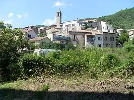 A general view of Saint-Jean-de-Valériscle | |
.svg.png.webp) Coat of arms | |
Location of Saint-Jean-de-Valériscle | |
 Saint-Jean-de-Valériscle 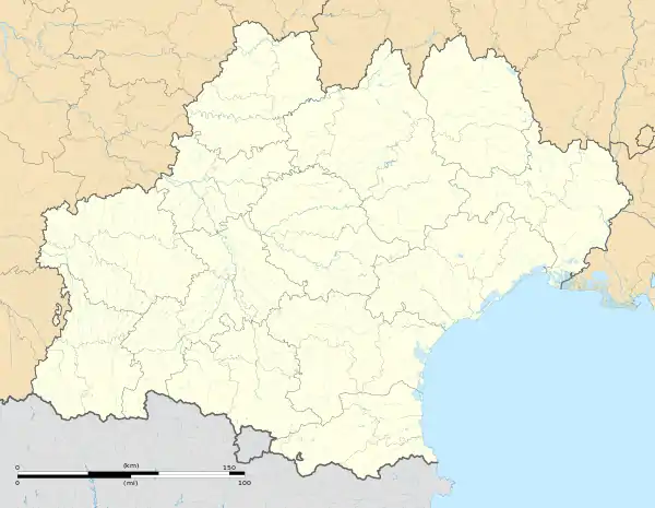 Saint-Jean-de-Valériscle | |
| Coordinates: 44°14′02″N 4°08′35″E / 44.2339°N 4.1431°E | |
| Country | France |
| Region | Occitania |
| Department | Gard |
| Arrondissement | Alès |
| Canton | Rousson |
| Intercommunality | Alès Agglomération |
| Government | |
| • Mayor (2022–2026) | Marc Jekal[1] |
| Area 1 | 8.15 km2 (3.15 sq mi) |
| Population | 599 |
| • Density | 73/km2 (190/sq mi) |
| Time zone | UTC+01:00 (CET) |
| • Summer (DST) | UTC+02:00 (CEST) |
| INSEE/Postal code | 30268 /30960 |
| Elevation | 184–529 m (604–1,736 ft) (avg. 210 m or 690 ft) |
| 1 French Land Register data, which excludes lakes, ponds, glaciers > 1 km2 (0.386 sq mi or 247 acres) and river estuaries. | |
Saint-Jean-de-Valériscle (French pronunciation: [sɛ̃ ʒɑ̃ də valeʁiskl]; Occitan: Sent Joan de Ceba) is a commune in the Gard department in southern France.
Population
| Year | Pop. | ±% p.a. |
|---|---|---|
| 1968 | 1,282 | — |
| 1975 | 824 | −6.12% |
| 1982 | 742 | −1.49% |
| 1990 | 672 | −1.23% |
| 1999 | 716 | +0.71% |
| 2009 | 727 | +0.15% |
| 2014 | 691 | −1.01% |
| 2020 | 605 | −2.19% |
| Source: INSEE[3] | ||
See also
References
- ↑ "Répertoire national des élus: les maires" (in French). data.gouv.fr, Plateforme ouverte des données publiques françaises. 4 May 2022.
- ↑ "Populations légales 2021". The National Institute of Statistics and Economic Studies. 28 December 2023.
- ↑ Population en historique depuis 1968, INSEE
Wikimedia Commons has media related to Saint-Jean-de-Valériscle.
This article is issued from Wikipedia. The text is licensed under Creative Commons - Attribution - Sharealike. Additional terms may apply for the media files.