Saint-Denis-sur-Scie | |
|---|---|
 Coat of arms | |
Location of Saint-Denis-sur-Scie | |
 Saint-Denis-sur-Scie 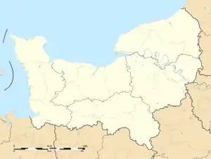 Saint-Denis-sur-Scie | |
| Coordinates: 49°42′20″N 1°05′42″E / 49.7056°N 1.095°E | |
| Country | France |
| Region | Normandy |
| Department | Seine-Maritime |
| Arrondissement | Dieppe |
| Canton | Luneray |
| Intercommunality | CC Terroir de Caux |
| Government | |
| • Mayor (2020–2026) | Henri Dupuis[1] |
| Area 1 | 8.63 km2 (3.33 sq mi) |
| Population | 682 |
| • Density | 79/km2 (200/sq mi) |
| Time zone | UTC+01:00 (CET) |
| • Summer (DST) | UTC+02:00 (CEST) |
| INSEE/Postal code | 76574 /76890 |
| Elevation | 96–161 m (315–528 ft) (avg. 98 m or 322 ft) |
| 1 French Land Register data, which excludes lakes, ponds, glaciers > 1 km2 (0.386 sq mi or 247 acres) and river estuaries. | |
Saint-Denis-sur-Scie (French pronunciation: [sɛ̃ dəni syʁ si], literally Saint-Denis on Scie) is a commune in the Seine-Maritime department in the Normandy region in northern France.
Geography
A farming village situated by the banks of the river Scie in the Pays de Caux at the junction of the D57 with the D22 road, some 15 miles (24 km) south of Dieppe.
Heraldry
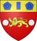
Arms of Saint-Denis-sur-Scie |
The arms of Saint-Denis-sur-Scie are blazoned : Gules, a leopard Or between 2 plates [argent], and on a chief Or a billet between 2 roses azure, barbed vert.
|
Population
| Year | Pop. | ±% p.a. |
|---|---|---|
| 1968 | 360 | — |
| 1975 | 295 | −2.80% |
| 1982 | 300 | +0.24% |
| 1990 | 349 | +1.91% |
| 1999 | 386 | +1.13% |
| 2007 | 444 | +1.77% |
| 2012 | 579 | +5.45% |
| 2017 | 674 | +3.09% |
| Source: INSEE[3] | ||
Places of interest
See also
References
- ↑ Liste des maires du département de la Seine-Maritime, 10 August 2020
- ↑ "Populations légales 2021". The National Institute of Statistics and Economic Studies. 28 December 2023.
- ↑ Population en historique depuis 1968, INSEE
Wikimedia Commons has media related to Saint-Denis-sur-Scie.
This article is issued from Wikipedia. The text is licensed under Creative Commons - Attribution - Sharealike. Additional terms may apply for the media files.