Sagana | |
|---|---|
| Nickname: "Thagana" | |
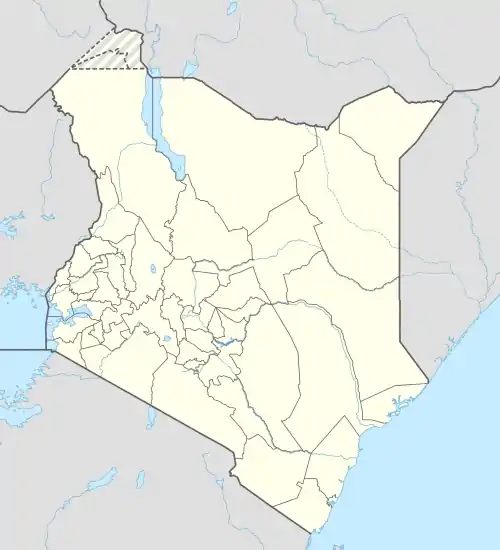
 Sagana Location of Sagana | |
| Coordinates: 00°39′S 37°12′E / 0.650°S 37.200°E | |
| Country | Kenya |
| County | Kirinyaga |
| Founded | 1920 |
| Government | |
| • Governor | Governor Ann Waiguru |
| Area | |
| • Total | 37 km2 (14 sq mi) |
| Elevation | 2,161 m (5,450 ft) |
| Population (2014) | |
| • Total | 13,000 |
| • Density | 512/km2 (1,330/sq mi) |
| Estimates | |
| Time zone | UTC+3 (EAT) |
| Area code | 060 |
Sagana is a small industrial town in Kirinyaga District, Kenya. It is along the Nairobi-Nyeri highway, 100 kilometres north of Nairobi, the capital of Kenya. Its name comes from Kenya's longest river, Sagana River which is also called Thagana. The town also inspired the rhumba song "Afro mtoto wa Sagana". The town and its surroundings have a growing hospitality industry along the riverline of River Sagana with cottages, water sports, and other tourist attractions being established.
Notable businesses
- Napoleons Rafting Camp Sagana
- Sagana Technical Institute
- Sagana Country Lodge
- Highcrest Preparatory School
- Sagana Fisheries
- Sagana Tanneries Limited
- Havila Resort
- Suncity Resort
- Bethany House
- Frapa Leisure Gardens & Hotel
- Mutisky Motel and Lodge
- Apollo tours
- Maguna's Supermarket
Climate
Sagana has 2 distinct rainy seasons and dry weather throughout the year. The average 30 year annual rainfall is 1,166 mm.
The warmest period is February through April with a distinct cool season between June and August, when rainfall is at a minimum. Even though there is little rain, the skies tend to be overcast much of the day during this period. A rainy period known as the “short rains” occurs between October and December. The “long rains” fall from March through May with a single-month peak of 500 mm or more in April.

Temperatures
Daily average: 17 to 23 °C Cool season average: 17 to 19 °C Warm season average: 19 to 23 °C Daily minimum: 14 to 19 °C Daily maximum: 20 to 30 °C
Topography
Sagana is situated at the edge of a large plain at the southern foot of Mt. Kenya. Soils were formed on volcanic rocks from Mt. Kenya — latest Pliocene to Pleistocene basalts, phonolites, and pyroclastics. In areas with free drainage conditions on moderate to steep slopes, lateritic and red to reddish brown soils are present. Some areas with black cotton soils indicate that the soils have formed under restricted drainage conditions, which are the result of low rainfall and the presence of level to moderate slopes.
History
The town is known to have started in the early 19th Century. Sagana was home to the only railway station in Kirinyaga district.[1]
See also
References
- ↑ Chao (12 April 2016). "30 YEARS IN THE RAILWAYS - MR. GAKUNGA'S STORY". www.savetherailway.com. #SAVETHERAILWAY. Retrieved 18 May 2019.