| Rupt de Mad | |
|---|---|
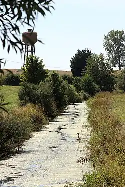 The Rupt de Mad at Lahayville | |
  | |
| Location | |
| Country | France |
| Physical characteristics | |
| Source | |
| • location | Geville |
| • coordinates | 48°47′48″N 05°42′33″E / 48.79667°N 5.70917°E |
| • elevation | 240 m (790 ft) |
| Mouth | |
• location | Moselle |
• coordinates | 49°00′47″N 06°02′38″E / 49.01306°N 6.04389°E |
• elevation | 170 m (560 ft) |
| Length | 54.6 km (33.9 mi) |
| Basin size | 385 km2 (149 sq mi) |
| Discharge | |
| • average | 3.65 m3/s (129 cu ft/s) |
| Basin features | |
| Progression | Moselle→ Rhine→ North Sea |
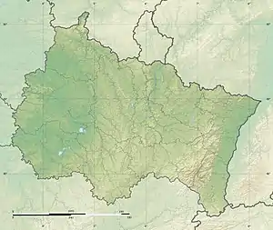
The Rupt de Mad (French pronunciation: [ʁypt də mad]) is a 54.6-kilometre (33.9 mi) long river in the Meuse and Meurthe-et-Moselle départements, northeastern France.[1] Its source is several small streams which rise at Geville, 17 kilometres (11 mi) northwest of Toul. It flows generally northeast. It is a left tributary of the Moselle into which it flows at Arnaville, 15 kilometres (9 mi) southwest of Metz.
Départements and communes along its course
This list is ordered from source to mouth:
- Meuse: Geville, Broussey-Raulecourt, Bouconville-sur-Madt, Rambucourt, Xivray-et-Marvoisin, Richecourt, Lahayville
- Meurthe-et-Moselle: Saint-Baussant, Essey-et-Maizerais, Pannes, Euvezin, Bouillonville, Thiaucourt-Regniéville, Jaulny, Rembercourt-sur-Mad, Waville, Villecey-sur-Mad, Onville, Vandelainville, Bayonville-sur-Mad, Arnaville
References
Wikimedia Commons has media related to Rupt de Mad.
Tributaries of the river Moselle | ||
|---|---|---|
| From the left | ||
| From the right | ||
This article is issued from Wikipedia. The text is licensed under Creative Commons - Attribution - Sharealike. Additional terms may apply for the media files.