Ruhland | |
|---|---|
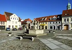 Town square | |
 Coat of arms | |
Location of Ruhland within Oberspreewald-Lausitz district 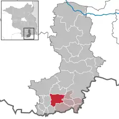 | |
 Ruhland 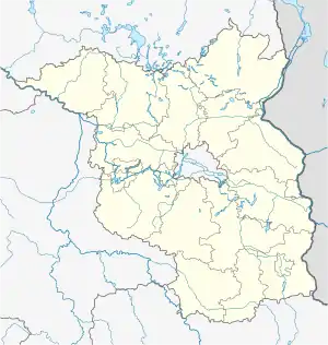 Ruhland | |
| Coordinates: 51°28′00″N 13°52′00″E / 51.46667°N 13.86667°E | |
| Country | Germany |
| State | Brandenburg |
| District | Oberspreewald-Lausitz |
| Municipal assoc. | Ruhland |
| Government | |
| • Mayor (2019–24) | Martin Höntsch[1] (SPD) |
| Area | |
| • Total | 37.12 km2 (14.33 sq mi) |
| Elevation | 96 m (315 ft) |
| Population (2021-12-31)[2] | |
| • Total | 3,767 |
| • Density | 100/km2 (260/sq mi) |
| Time zone | UTC+01:00 (CET) |
| • Summer (DST) | UTC+02:00 (CEST) |
| Postal codes | 01945 |
| Dialling codes | 035752 |
| Vehicle registration | OSL |
| Website | www.ruhland.de |
ⓘ (Sorbian: Rólany) is a town in the Oberspreewald-Lausitz district, in Upper Lusatia, Brandenburg, in eastern Germany. It is situated on the river Schwarze Elster, 12 kilometres (7.5 mi) southwest of Senftenberg.
Ruhland station is a major railway junction, for freight and for passenger services. The hourly 4-way connection between locomotive-hauled passenger services converging from Hoyerswerda, Cottbus, Leipzig and Dresden is a most impressive sight.
History
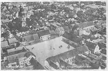
It was first mentioned in 1317. The town was at various times ruled by Bohemian, Hungarian, Saxon and Polish monarchs, before it was annexed by Prussia in 1815. In 1705, the town was visited twice by Augustus II the Strong.[3] From 1815 to 1825, Ruhland was part of the Province of Brandenburg, from 1825 to 1919 of the Province of Silesia, from 1919 to 1938 of the Province of Lower Silesia, again from 1938 to 1941 of the Province of Silesia and again from 1941 to 1945 of the Province of Lower Silesia. From 1945 to 1952 it was part of Saxony and from 1952 to 1990 of the Bezirk Cottbus of East Germany.[4]
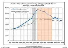
Demography
|
|
References
- ↑ Landkreis Oberspreewald-Lausitz Wahl der Bürgermeisterin / des Bürgermeisters, accessed 2 July 2021.
- ↑ "Bevölkerungsentwicklung und Flächen der kreisfreien Städte, Landkreise und Gemeinden im Land Brandenburg 2021" (PDF). Amt für Statistik Berlin-Brandenburg (in German). June 2022.
- ↑ Paulitz, Johann Gottlob. Chronik der Stadt Senftenberg und der zum ehemaligen Amte Senftenberg gehörigen Ortschaften (in German). Dresden. pp. 234–235.
- ↑ "03812-hildebrand". 2014-08-08. Archived from the original on 2014-08-08. Retrieved 2023-05-18.
- ↑ Detailed data sources are to be found in the Wikimedia Commons.Population Projection Brandenburg at Wikimedia Commons