Richland Y, Washington | |
|---|---|
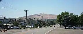 Looking west toward Badger Mountain. | |
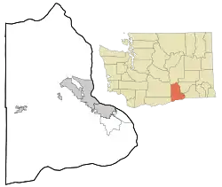 Richland Y, Washington Location of Richland Y, Washington | |
| Coordinates: 46°14′12″N 119°13′59″W / 46.2368015°N 119.2330713°W[1] | |
| Country | United States |
| State | Washington |
| County | Benton |
| Elevation | 381 ft (116 m) |
| Time zone | UTC-8 (Pacific (PST)) |
| • Summer (DST) | UTC-7 (PDT) |
| ZIP code | 99353 |
| Area code | 509 |
| GNIS feature ID | 1513420[2] |
Richland Y is an unincorporated community in Benton County, Washington, United States. It lies within the eastern city limits of Richland.
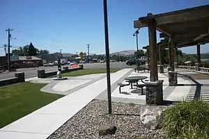
Looking west from park commemorating Sacajawea toward Badger Mountain through business zone
Wikimedia Commons has media related to Richland Y, Washington.
References
- ↑ "Richland Y". Geographic Names Information System. United States Geological Survey, United States Department of the Interior. Retrieved October 28, 2012.
- 1 2 "US Board on Geographic Names". United States Geological Survey. October 25, 2007. Retrieved January 31, 2008.
Municipalities and communities of Benton County, Washington, United States | ||
|---|---|---|
| Cities |  Map of Washington highlighting Benton County | |
| CDPs | ||
| Unincorporated communities | ||
| Ghost towns | ||
| ||
This article is issued from Wikipedia. The text is licensed under Creative Commons - Attribution - Sharealike. Additional terms may apply for the media files.