| Reminghton Glacier | |
|---|---|
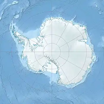
 Location of Sentinel Range in Western Antarctica | |
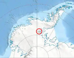
 Location of Remington Glacier in Antarctica | |
| Location | Ellsworth Land |
| Coordinates | 78°34′00″S 84°18′00″W / 78.56667°S 84.30000°W |
| Length | 7 nautical miles (13 km; 8.1 mi) |
| Thickness | unknown |
| Terminus | Hough Glacier and Johnson Spur |
| Status | unknown |
Remington Glacier is a steep glacier about 7 nautical miles (13 km; 8.1 mi) long in Doyran Heights in the Sentinel Range of Ellsworth Mountains, Antarctica. It rises just north of McPherson Peak and flows east-southeast to debouch between the terminus of Hough Glacier and Johnson Spur.
Background
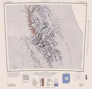
Central and southern Sentinel Range map[1]
Discovered by U.S. Navy Squadron VX-6 on photographic flights of December 14–15, 1959, and mapped by United States Geological Survey (USGS) from these photos.
Named by Advisory Committee on Antarctic Names (US-ACAN) for Edward W. Remington, glaciologist at the South Pole Station during the IGY in 1957.
See also
Maps
- Vinson Massif. Scale 1:250 000 topographic map. Reston, Virginia: US Geological Survey, 1988.
- Antarctic Digital Database (ADD). Scale 1:250000 topographic map of Antarctica. Scientific Committee on Antarctic Research (SCAR). Since 1993, regularly upgraded and updated.
References
- ↑ Vinson Massif. Scale 1:250 000 topographic map. Reston, Virginia: US Geological Survey, 1988.
 This article incorporates public domain material from "Remington Glacier". Geographic Names Information System. United States Geological Survey.
This article is issued from Wikipedia. The text is licensed under Creative Commons - Attribution - Sharealike. Additional terms may apply for the media files.