| President Range | |
|---|---|
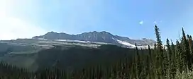 The President Range in Yoho National Park | |
| Highest point | |
| Peak | The President |
| Elevation | 3,138 m (10,295 ft)[1] |
| Listing | Mountains of British Columbia |
| Coordinates | 51°30′02″N 116°33′42″W / 51.50056°N 116.56167°W[2] |
| Dimensions | |
| Area | 120 km2 (46 sq mi) |
| Geography | |
 | |
| Country | Canada |
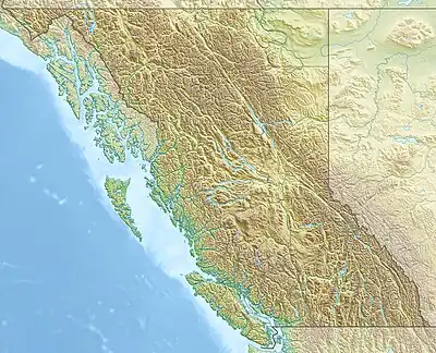
| Province | British Columbia |
| Protected area | Yoho National Park |
| Range coordinates | 51°30′N 116°33′W / 51.500°N 116.550°W[3] |
| Parent range | Canadian Rockies |
| Topo map | NTS 82N7 Golden[3] |
The President Range is a mountain range of the Canadian Rockies, located in the northwestern section of Yoho National Park. The range is named for the highest peak in the range, The President.
List of Mountains
This range includes the following mountains:
| Name | Elevation | Prominence | FA | Coordinates | ||
|---|---|---|---|---|---|---|
| m | ft | m | ft | |||
| The President | 10,295
style="text-align:right;" data-sort-value="7002658000000000000"|658 |
2,159 | 1901 | 51°30′3″N 116°33′43″W / 51.50083°N 116.56194°W | ||
| The Vice President | 10,095
style="text-align:right;" data-sort-value="7002157000000000000"|157 |
515 | 1901 | 51°30′2″N 116°33′0″W / 51.50056°N 116.55000°W | ||
| Mount Carnarvon | 9,993
style="text-align:right;" data-sort-value="7002406000000000000"|406 |
1,332 | 1904 | 51°28′13″N 116°35′20″W / 51.47028°N 116.58889°W | ||
| Michael Peak | 8,862
style="text-align:right;" data-sort-value="7001450000000000000"|45 |
148 | 1900 | 51°28′58″N 116°30′47″W / 51.48278°N 116.51306°W | ||
| Mount Field | 8,671
style="text-align:right;" data-sort-value="7002182000000000000"|182 |
597 | 1887 | 51°25′50″N 116°27′50″W / 51.43056°N 116.46389°W | ||
| Mount Burgess | 8,527
style="text-align:right;" data-sort-value="7002418000000000000"|418 |
1,371 | 1892 | 51°25′12″N 116°30′19″W / 51.42000°N 116.50528°W | ||
| Emerald Peak | 8,419
style="text-align:right;" data-sort-value="7002166000000000000"|166 |
545 | 51°27′35″N 116°34′13″W / 51.45972°N 116.57028°W | |||
References
- ↑ "Topographic map of The President". opentopomap.org. Retrieved 2023-07-09.
- ↑ "The President". BC Geographical Names. Retrieved 2023-07-09.
- 1 2 "President Range". Geographical Names Data Base. Natural Resources Canada. Retrieved 2023-07-09.
This article is issued from Wikipedia. The text is licensed under Creative Commons - Attribution - Sharealike. Additional terms may apply for the media files.