Poysdorf | |
|---|---|
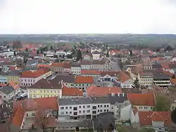 Panorama of Poysdorf | |
 Coat of arms | |
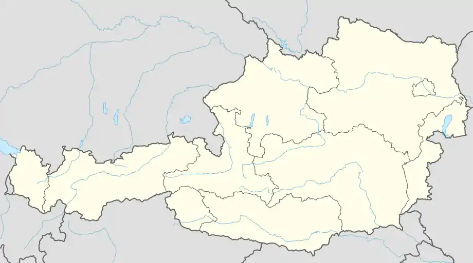 Poysdorf Location within Austria | |
| Coordinates: 48°40′N 16°36′E / 48.667°N 16.600°E | |
| Country | Austria |
| State | Lower Austria |
| District | Mistelbach |
| Government | |
| • Mayor | Thomas Grießl (ÖVP) |
| Area | |
| • Total | 97.26 km2 (37.55 sq mi) |
| Elevation | 225 m (738 ft) |
| Population (2018-01-01)[2] | |
| • Total | 5,527 |
| • Density | 57/km2 (150/sq mi) |
| Time zone | UTC+1 (CET) |
| • Summer (DST) | UTC+2 (CEST) |
| Postal code | 2170 |
| Area code | 02552 |
| Website | www.poysdorf.at |
Poysdorf is a town in the district of Mistelbach in the Austrian state of Lower Austria.
Population
| Year | Pop. | ±% |
|---|---|---|
| 1869 | 7,071 | — |
| 1880 | 7,524 | +6.4% |
| 1890 | 7,836 | +4.1% |
| 1900 | 8,006 | +2.2% |
| 1910 | 8,238 | +2.9% |
| 1923 | 7,744 | −6.0% |
| 1934 | 8,074 | +4.3% |
| 1939 | 8,257 | +2.3% |
| 1951 | 7,715 | −6.6% |
| 1961 | 6,785 | −12.1% |
| 1971 | 6,159 | −9.2% |
| 1981 | 5,641 | −8.4% |
| 1991 | 5,447 | −3.4% |
| 2001 | 5,606 | +2.9% |
| 2011 | 5,498 | −1.9% |
Sights
- Vino Versum Poysdorf, a museum about wine and the history of Poysdorf as one of the leading wine towns in Austria.
Climate
| Climate data for Poysdorf 1981-2010 | |||||||||||||
|---|---|---|---|---|---|---|---|---|---|---|---|---|---|
| Month | Jan | Feb | Mar | Apr | May | Jun | Jul | Aug | Sep | Oct | Nov | Dec | Year |
| Record high °C (°F) | 17.7 (63.9) |
18.4 (65.1) |
24.2 (75.6) |
27.3 (81.1) |
33.2 (91.8) |
37.1 (98.8) |
37.1 (98.8) |
38.4 (101.1) |
31.5 (88.7) |
27.5 (81.5) |
20.4 (68.7) |
15.2 (59.4) |
38.4 (101.1) |
| Mean daily maximum °C (°F) | 2.1 (35.8) |
4.4 (39.9) |
9.6 (49.3) |
15.9 (60.6) |
21 (70) |
24 (75) |
26.7 (80.1) |
26.3 (79.3) |
20.8 (69.4) |
14.6 (58.3) |
7.5 (45.5) |
2.7 (36.9) |
14.6 (58.3) |
| Daily mean °C (°F) | −1.2 (29.8) |
0.2 (32.4) |
4.5 (40.1) |
9.9 (49.8) |
15.1 (59.2) |
18.1 (64.6) |
20.3 (68.5) |
19.6 (67.3) |
14.6 (58.3) |
9.2 (48.6) |
4 (39) |
−0.1 (31.8) |
9.5 (49.1) |
| Mean daily minimum °C (°F) | −3.9 (25.0) |
−2.8 (27.0) |
0.7 (33.3) |
4.6 (40.3) |
9.3 (48.7) |
12.3 (54.1) |
14.1 (57.4) |
13.9 (57.0) |
10.1 (50.2) |
5.6 (42.1) |
1.4 (34.5) |
−2.5 (27.5) |
5.2 (41.4) |
| Record low °C (°F) | −27.4 (−17.3) |
−23.8 (−10.8) |
−17 (1) |
−6.4 (20.5) |
−1 (30) |
0.7 (33.3) |
1.5 (34.7) |
5 (41) |
0.5 (32.9) |
−7.4 (18.7) |
−14.4 (6.1) |
−23 (−9) |
−27.4 (−17.3) |
| Average precipitation mm (inches) | 30 (1.2) |
30 (1.2) |
42 (1.7) |
37 (1.5) |
64 (2.5) |
65 (2.6) |
67 (2.6) |
58 (2.3) |
58 (2.3) |
32 (1.3) |
41 (1.6) |
39 (1.5) |
562 (22.1) |
| Average snowfall cm (inches) | 12 (4.7) |
10 (3.9) |
5 (2.0) |
0 (0) |
0 (0) |
0 (0) |
0 (0) |
0 (0) |
0 (0) |
0 (0) |
3 (1.2) |
10 (3.9) |
41 (16) |
| Average relative humidity (%) (at 14:00) | 75.9 | 66.8 | 59 | 50.6 | 52.3 | 53 | 49.9 | 48.7 | 55 | 61.6 | 73.5 | 79.1 | 60.4 |
| Mean monthly sunshine hours | 61 | 95 | 139 | 199 | 239 | 235 | 256 | 248 | 179 | 132 | 63 | 46 | 1,893 |
| Source: Central Institute for Meteorology and Geodynamics[3] | |||||||||||||
References
- ↑ "Dauersiedlungsraum der Gemeinden Politischen Bezirke und Bundesländer - Gebietsstand 1.1.2018". Statistics Austria. Retrieved 10 March 2019.
- ↑ "Einwohnerzahl 1.1.2018 nach Gemeinden mit Status, Gebietsstand 1.1.2018". Statistics Austria. Retrieved 9 March 2019.
- ↑ "Klimamittel - ZAMG" (in German). Central Institute for Meteorology and Geodynamics. Retrieved 31 May 2020.
External links
Wikimedia Commons has media related to Poysdorf.
This article is issued from Wikipedia. The text is licensed under Creative Commons - Attribution - Sharealike. Additional terms may apply for the media files.