Port-Saint-Père | |
|---|---|
Commune | |
.jpg.webp) | |
 Coat of arms | |
Location of Port-Saint-Père | |
 Port-Saint-Père 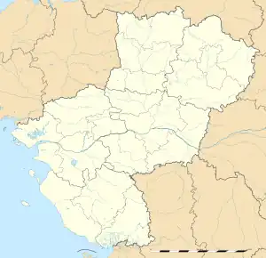 Port-Saint-Père | |
| Coordinates: 47°08′00″N 1°45′00″W / 47.1333°N 1.75°W | |
| Country | France |
| Region | Pays de la Loire |
| Department | Loire-Atlantique |
| Arrondissement | Nantes |
| Canton | Machecoul-Saint-Même |
| Intercommunality | CA Pornic Agglo Pays de Retz |
| Government | |
| • Mayor (2020–2026) | Gaëtan Léauté[1] |
| Area 1 | 32.57 km2 (12.58 sq mi) |
| Population | 3,013 |
| • Density | 93/km2 (240/sq mi) |
| Time zone | UTC+01:00 (CET) |
| • Summer (DST) | UTC+02:00 (CEST) |
| INSEE/Postal code | 44133 /44710 |
| Elevation | 0–52 m (0–171 ft) |
| 1 French Land Register data, which excludes lakes, ponds, glaciers > 1 km2 (0.386 sq mi or 247 acres) and river estuaries. | |
Port-Saint-Père (French pronunciation: [pɔʁ sɛ̃ pɛʁ] ⓘ; Breton: Porzh-Pêr) is a commune in the Loire-Atlantique department in western France.
Geography
Port-Saint-Père is situated on the west bank of the Acheneau, northwest of the Lac de Grand-Lieu.
Population
|
| ||||||||||||||||||||||||||||||||||||||||||||||||||||||
| Source: EHESS[3] and INSEE (1968-2017)[4] | |||||||||||||||||||||||||||||||||||||||||||||||||||||||
Sights
- Planète Sauvage, safari park
Transport
Port-Saint-Père-Saint-Mars station is served by train services between Pornic, Saint-Gilles-Croix-de-Vie and Nantes.
See also
References
- ↑ "Répertoire national des élus: les maires" (in French). data.gouv.fr, Plateforme ouverte des données publiques françaises. 13 September 2022.
- ↑ "Populations légales 2021". The National Institute of Statistics and Economic Studies. 28 December 2023.
- ↑ Des villages de Cassini aux communes d'aujourd'hui: Commune data sheet Port-Saint-Père, EHESS (in French).
- ↑ Population en historique depuis 1968, INSEE
Wikimedia Commons has media related to Port-Saint-Père.
This article is issued from Wikipedia. The text is licensed under Creative Commons - Attribution - Sharealike. Additional terms may apply for the media files.