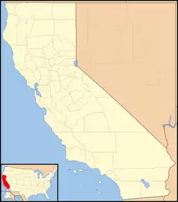
38°49′05″N 120°04′40″W / 38.81806°N 120.07778°W
Phillips | |
|---|---|
 Phillips Location in California  Phillips Phillips (the United States) | |
| Coordinates: 38°49′05″N 120°04′40″W / 38.81806°N 120.07778°W | |
| Country | United States |
| State | California |
| County | El Dorado County |
| Elevation | 6,873 ft (2,095 m) |
| Population (2010) | |
| • Total | 18 |
Phillips (formerly, Phillip's[1] and Vade Post Office[2]) is a small unincorporated community in El Dorado County, California.[1] It is located on the South Fork of the American River, 2.5 miles (4 km) west of Echo Summit,[2] at an elevation of 6,873 feet (2095 m).[1] It is the site of the Sierra-at-Tahoe ski resort. The ZIP code is 95720. The community is inside area code 530.
Joseph Wells Davis Phillips began cattle ranching here in 1859, and opened a hotel in 1863.[2] The Vade post office operated at Phillips from 1912 to 1961.[2] As of 2020, the Phillips family still owned the townsite, which has long been a site for manual surveys of Sierra Nevada snowpack.[3]
References
- 1 2 3 4 U.S. Geological Survey Geographic Names Information System: Phillips, California
- 1 2 3 4 Durham, David L. (1998). California's Geographic Names: A Gazetteer of Historic and Modern Names of the State. Clovis, Calif.: Word Dancer Press. p. 537. ISBN 1-884995-14-4.
- ↑ Gonzalez, Vicki (January 30, 2020). "Historic Phillips Station rebuilds after fire in El Dorado County". KCRA 3 News. Sacramento, CA. Retrieved December 27, 2023.
This article is issued from Wikipedia. The text is licensed under Creative Commons - Attribution - Sharealike. Additional terms may apply for the media files.
