Přibyslavice | |
|---|---|
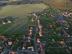 Aerial view | |
.svg.png.webp) Flag .svg.png.webp) Coat of arms | |
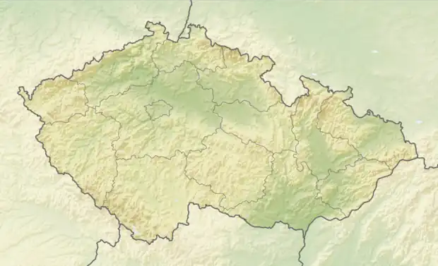 Přibyslavice Location in the Czech Republic | |
| Coordinates: 49°16′43″N 16°15′59″E / 49.27861°N 16.26639°E | |
| Country | |
| Region | South Moravian |
| District | Brno-Country |
| First mentioned | 1175 |
| Area | |
| • Total | 8.52 km2 (3.29 sq mi) |
| Elevation | 497 m (1,631 ft) |
| Population (2023-01-01)[1] | |
| • Total | 525 |
| • Density | 62/km2 (160/sq mi) |
| Time zone | UTC+1 (CET) |
| • Summer (DST) | UTC+2 (CEST) |
| Postal code | 664 83 |
| Website | www |
Přibyslavice is a municipality and village in Brno-Country District in the South Moravian Region of the Czech Republic, on the border with the Vysočina Region. It has about 500 inhabitants.
Přibyslavice lies approximately 27 kilometres (17 mi) west of Brno and 161 km (100 mi) south-east of Prague.
Administrative parts
The village of Radoškov is an administrative part of Přibyslavice.
Demographics
| Year | Pop. | ±% |
|---|---|---|
| 1869 | 860 | — |
| 1880 | 966 | +12.3% |
| 1890 | 807 | −16.5% |
| 1900 | 797 | −1.2% |
| 1910 | 756 | −5.1% |
| 1921 | 811 | +7.3% |
| 1930 | 740 | −8.8% |
| 1950 | 631 | −14.7% |
| 1961 | 646 | +2.4% |
| 1970 | 563 | −12.8% |
| 1980 | 437 | −22.4% |
| 1991 | 422 | −3.4% |
| 2001 | 415 | −1.7% |
| 2011 | 463 | +11.6% |
| 2021 | 534 | +15.3% |
| Source: Censuses[2][3] | ||
References
- ↑ "Population of Municipalities – 1 January 2023". Czech Statistical Office. 2023-05-23.
- ↑ "Historický lexikon obcí České republiky 1869–2011 – Okres Brno-venkov" (in Czech). Czech Statistical Office. 2015-12-21. pp. 7–8.
- ↑ "Population Census 2021: Population by sex". Public Database. Czech Statistical Office. 2021-03-27.
Wikimedia Commons has media related to Přibyslavice (Brno-Country District).
This article is issued from Wikipedia. The text is licensed under Creative Commons - Attribution - Sharealike. Additional terms may apply for the media files.