Munson Township | |
|---|---|
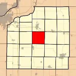 Location in Henry County | |
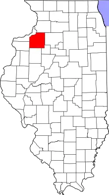 Henry County's location in Illinois | |
| Coordinates: 41°21′57″N 90°08′48″W / 41.36583°N 90.14667°W | |
| Country | |
| State | |
| County | Henry |
| Established | November 4, 1856 |
| Area | |
| • Total | 35.94 sq mi (93.1 km2) |
| • Land | 35.94 sq mi (93.1 km2) |
| • Water | 0 sq mi (0 km2) 0% |
| Elevation | 741 ft (226 m) |
| Population (2010) | |
| • Estimate (2016)[1] | 393 |
| • Density | 11.1/sq mi (4.3/km2) |
| Time zone | UTC-6 (CST) |
| • Summer (DST) | UTC-5 (CDT) |
| ZIP codes | 61235, 61238, 61254 |
| FIPS code | 17-073-51388 |
Munson Township is one of twenty-four townships in Henry County, Illinois, USA. As of the 2010 census, its population was 400 and it contained 132 housing units.[2] Munson changed its name from Centre township on April 13, 1857.
Geography
According to the 2010 census, the township has a total area of 35.94 square miles (93.1 km2), all land.[2]
Adjacent townships
- Geneseo Township (north)
- Atkinson Township (northeast)
- Cornwall Township (east)
- Burns Township (southeast)
- Cambridge Township (south)
- Andover Township (southwest)
- Osco Township (west)
Cemeteries
The township contains these two cemeteries: Greenlee and Munson.
Major highways
Demographics
| Census | Pop. | Note | %± |
|---|---|---|---|
| 2016 (est.) | 393 | [1] | |
| U.S. Decennial Census[3] | |||
School districts
- Cambridge Community Unit School District 227
- Geneseo Community Unit School District 228
Political districts
- Illinois's 14th congressional district
- State House District 71
- State House District 74
- State Senate District 36
- State Senate District 37
References
- United States Census Bureau 2008 TIGER/Line Shapefiles
- "Munson Township". Geographic Names Information System. United States Geological Survey, United States Department of the Interior. Retrieved September 18, 2009.
- United States National Atlas
- 1 2 "Population and Housing Unit Estimates". Retrieved June 9, 2017.
- 1 2 "Population, Housing Units, Area, and Density: 2010 - County -- County Subdivision and Place -- 2010 Census Summary File 1". United States Census. Archived from the original on February 12, 2020. Retrieved May 28, 2013.
- ↑ "Census of Population and Housing". Census.gov. Retrieved June 4, 2016.
External links
Places adjacent to Munson Township, Henry County, Illinois | |
|---|---|
Municipalities and communities of Henry County, Illinois, United States | ||
|---|---|---|
| Cities | Map of Illinois highlighting Henry County | |
| Towns | ||
| Villages | ||
| Townships | ||
| CDPs | ||
| Other communities | ||
| Footnotes | ‡This populated place also has portions in an adjacent county or counties | |
This article is issued from Wikipedia. The text is licensed under Creative Commons - Attribution - Sharealike. Additional terms may apply for the media files.