Monterfil
| |
|---|---|
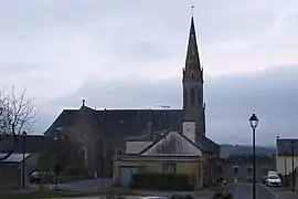 The church of Saint-Étienne | |
 Coat of arms | |
Location of Monterfil | |
 Monterfil  Monterfil | |
| Coordinates: 48°04′00″N 1°58′39″W / 48.0667°N 1.9775°W | |
| Country | France |
| Region | Brittany |
| Department | Ille-et-Vilaine |
| Arrondissement | Rennes |
| Canton | Montfort-sur-Meu |
| Intercommunality | Brocéliande |
| Government | |
| • Mayor (2020–2026) | Michel Duault[1] |
| Area 1 | 16.94 km2 (6.54 sq mi) |
| Population | 1,338 |
| • Density | 79/km2 (200/sq mi) |
| Time zone | UTC+01:00 (CET) |
| • Summer (DST) | UTC+02:00 (CEST) |
| INSEE/Postal code | 35187 /35160 |
| Elevation | 32–132 m (105–433 ft) |
| 1 French Land Register data, which excludes lakes, ponds, glaciers > 1 km2 (0.386 sq mi or 247 acres) and river estuaries. | |
Monterfil (French pronunciation: [mɔ̃tɛʁfil]; Breton: Mousterfil; Gallo: Mósterfiu) is a commune in the Ille-et-Vilaine department of Brittany in northwestern France.
Population
| Year | Pop. | ±% |
|---|---|---|
| 1962 | 639 | — |
| 1968 | 594 | −7.0% |
| 1975 | 720 | +21.2% |
| 1982 | 868 | +20.6% |
| 1990 | 915 | +5.4% |
| 1999 | 978 | +6.9% |
| 2008 | 1,241 | +26.9% |
See also
References
- ↑ "Répertoire national des élus: les maires". data.gouv.fr, Plateforme ouverte des données publiques françaises (in French). 2 December 2020.
- ↑ "Populations légales 2021". The National Institute of Statistics and Economic Studies. 28 December 2023.
External links
Wikimedia Commons has media related to Monterfil.
- Base Mérimée: Search for heritage in the commune, Ministère français de la Culture. (in French)
- Mayors of Ille-et-Vilaine Association (in French)
This article is issued from Wikipedia. The text is licensed under Creative Commons - Attribution - Sharealike. Additional terms may apply for the media files.