Mons-Boubert | |
|---|---|
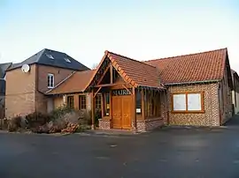 The town hall in Mons-Boubert | |
Location of Mons-Boubert | |
 Mons-Boubert 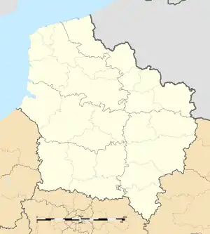 Mons-Boubert | |
| Coordinates: 50°07′47″N 1°39′43″E / 50.1297°N 1.6619°E | |
| Country | France |
| Region | Hauts-de-France |
| Department | Somme |
| Arrondissement | Abbeville |
| Canton | Abbeville-2 |
| Intercommunality | CA Baie de Somme |
| Government | |
| • Mayor (2020–2026) | Emmanuel Delahaye[1] |
| Area 1 | 9.53 km2 (3.68 sq mi) |
| Population | 569 |
| • Density | 60/km2 (150/sq mi) |
| Time zone | UTC+01:00 (CET) |
| • Summer (DST) | UTC+02:00 (CEST) |
| INSEE/Postal code | 80556 /80210 |
| Elevation | 5–71 m (16–233 ft) (avg. 20 m or 66 ft) |
| 1 French Land Register data, which excludes lakes, ponds, glaciers > 1 km2 (0.386 sq mi or 247 acres) and river estuaries. | |
Mons-Boubert (French pronunciation: [mɔ̃s bubɛʁ]; Picard: Monboubért) is a commune in the Somme department in Hauts-de-France in northern France.
Geography
The commune is situated on the D403 road, some 7 miles (11 km) west of Abbeville.
Population
| Year | Pop. | ±% p.a. |
|---|---|---|
| 1968 | 567 | — |
| 1975 | 519 | −1.26% |
| 1982 | 508 | −0.31% |
| 1990 | 506 | −0.05% |
| 1999 | 483 | −0.52% |
| 2007 | 537 | +1.33% |
| 2012 | 528 | −0.34% |
| 2017 | 558 | +1.11% |
| Source: INSEE[3] | ||
See also
References
- ↑ "Répertoire national des élus: les maires" (in French). data.gouv.fr, Plateforme ouverte des données publiques françaises. 13 September 2022.
- ↑ "Populations légales 2021". The National Institute of Statistics and Economic Studies. 28 December 2023.
- ↑ Population en historique depuis 1968, INSEE
Wikimedia Commons has media related to Mons-Boubert.
This article is issued from Wikipedia. The text is licensed under Creative Commons - Attribution - Sharealike. Additional terms may apply for the media files.