Lamas | |
|---|---|
 Coat of arms | |
 | |
| Coordinates: 41°29′49″N 8°25′59″W / 41.497°N 8.433°W | |
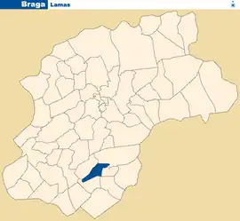
| Country | |
| Region | Norte |
| Intermunic. comm. | Cávado |
| District | Braga |
| Municipality | Braga |
| Area | |
| • Total | 1.25 km2 (0.48 sq mi) |
| Population (2011) | |
| • Total | 842 |
| • Density | 670/km2 (1,700/sq mi) |
| Time zone | UTC±00:00 (WET) |
| • Summer (DST) | UTC+01:00 (WEST) |
Lamas is a Portuguese Freguesia (parish), located in the municipality of Braga. The population in 2011 was 842,[1] in an area of 1.25 km².[2]
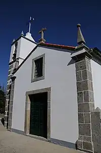
Lamas Church
References
- ↑ Instituto Nacional de Estatística
- ↑ "Áreas das freguesias, concelhos, distritos e país". Archived from the original on 2018-11-05. Retrieved 2018-11-05.
Wikimedia Commons has media related to Lamas (Braga).
This article is issued from Wikipedia. The text is licensed under Creative Commons - Attribution - Sharealike. Additional terms may apply for the media files.