La Guaira Bank
Placer de la Guaira | |
|---|---|
.jpg.webp) La Guaira Bank  La Guaira Bank | |
| Coordinates: 10°50′N 67°7′W / 10.833°N 67.117°W | |
| Sea | Caribbean |
| Area | La Guaira |
| Country | Venezuela |
| State | Vargas State |
| Minimum depth | 60 m |
| Languages | |
| • Official | Spanish |
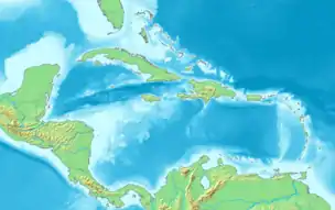
La Guaira Bank (Spanish: Placer de la Guaira),[1] is a large, completely submerged bank in Venezuela. It is located in the Caribbean Sea 20 km to the NNE off the northern shore of La Guaira.[2]
This reef has an excellent reputation for deep-sea angling.[3] Currents create an upwelling of nutrients that attracts large pelagic fish such as sailfish, marlin, yellowfin tuna and mahi-mahi.[4]
Geography
The La Guaira Bank is a Pleistocene structure that is wholly submerged. It is 19 km long and 6 km wide. Its depths range between 60 and 70 m, rising from the 260 m deep surrounding seabed of the continental platform.[5] La Guaira Bank is located close to the Carayaca Bank (Spanish: Placer de Carayaca), another structure that rises between 50 and 100 m from the surface.[6]
See also
References
- ↑ Pesquería artesanal de istiofóridos en Venezuela
- ↑ La Guaira - Geographical Names
- ↑ Fishing El Placer Bank, la Guaira, Venezuela
- ↑ Vargas State Tourism - "El Placer¨, un paraiso para la pesca de altura
- ↑ "Información Meteoceánica; Fachada Caribeña - Sector Oriental" (PDF). Archived from the original (PDF) on 2016-03-10. Retrieved 2016-03-10.
- ↑ Catch Rates for Sailfish (Istiophorus albicans) from the Small Scale Drift Gillnet Fishery of La Guaira, Venezuela: Period 1991-2007