La Chapelle-Agnon | |
|---|---|
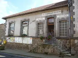 The town hall in La Chapelle-Agnon | |
.svg.png.webp) Coat of arms | |
Location of La Chapelle-Agnon | |
 La Chapelle-Agnon 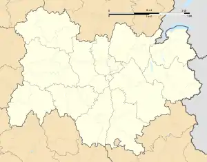 La Chapelle-Agnon | |
| Coordinates: 45°38′03″N 3°38′19″E / 45.6342°N 3.6386°E | |
| Country | France |
| Region | Auvergne-Rhône-Alpes |
| Department | Puy-de-Dôme |
| Arrondissement | Ambert |
| Canton | Les Monts du Livradois[1] |
| Government | |
| • Mayor (2020–2026) | Fabienne Gachon[2] |
| Area 1 | 26.08 km2 (10.07 sq mi) |
| Population | 342 |
| • Density | 13/km2 (34/sq mi) |
| Time zone | UTC+01:00 (CET) |
| • Summer (DST) | UTC+02:00 (CEST) |
| INSEE/Postal code | 63086 /63590 |
| Elevation | 470–1,003 m (1,542–3,291 ft) (avg. 700 m or 2,300 ft) |
| 1 French Land Register data, which excludes lakes, ponds, glaciers > 1 km2 (0.386 sq mi or 247 acres) and river estuaries. | |
La Chapelle-Agnon (French pronunciation: [la ʃapɛl aɲɔ̃]; Occitan: La Chapèla Anhon) is a commune in the Puy-de-Dôme department in Auvergne-Rhône-Alpes in central France.[4]
The commune of La Chapelle-Agnon is adherent to Parc naturel régional Livradois-Forez (Livradois-Forez Regional Nature Park)
See also
References
- ↑ "Décret 2014-210 du 21 février 2014 portant délimitation des cantons dans le département du Puy-de-Dôme" [2014-210 decree delimiting cantons of Puy-de-Dôme department]. Légifrance (in French). 21 February 2014.
- ↑ "Répertoire national des élus: les maires" (in French). data.gouv.fr, Plateforme ouverte des données publiques françaises. 13 September 2022.
- ↑ "Populations légales 2021". The National Institute of Statistics and Economic Studies. 28 December 2023.
- ↑ INSEE commune file
Wikimedia Commons has media related to La Chapelle-Agnon.
This article is issued from Wikipedia. The text is licensed under Creative Commons - Attribution - Sharealike. Additional terms may apply for the media files.