Johnson Covered Bridge No. 28 | |
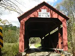 The bridge in October 2012 | |
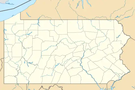  | |
| Location | Pennsylvania Route 320, south of Catawissa, Cleveland Township, Pennsylvania |
|---|---|
| Coordinates | 40°52′40″N 76°29′2″W / 40.87778°N 76.48389°W |
| Area | 0.1 acres (0.040 ha) |
| Built | 1882 |
| Built by | Daniel Stine |
| Architectural style | Warren Truss |
| MPS | Covered Bridges of Columbia and Montour Counties TR |
| NRHP reference No. | 79003185[1] |
| Added to NRHP | November 29, 1979 |
The Johnson Covered Bridge No. 28 is an historic, American, wooden covered bridge that is located in Cleveland Township in Columbia County, Pennsylvania.
It was listed on the National Register of Historic Places in 1979.[1]
History and architectural features
It is a 60.8-foot-long (18.5 m), Warren Truss bridge with a metal roof. Erected in 1882, it crosses Mugser Run, and is one of twenty-eight historic covered bridges in Columbia and Montour Counties.[2]
It was listed on the National Register of Historic Places in 1979.[1]
References
Wikimedia Commons has media related to Johnson Covered Bridge.
- 1 2 3 "National Register Information System". National Register of Historic Places. National Park Service. July 9, 2010.
- ↑ "National Historic Landmarks & National Register of Historic Places in Pennsylvania". CRGIS: Cultural Resources Geographic Information System. Archived from the original (Searchable database) on 2007-07-21. Retrieved 2012-01-17. Note: This includes Bill Pennesi and Susan M. Zacher (n.d.). "National Register of Historic Places Inventory Nomination Form: Johnson Covered Bridge No. 28" (PDF). Retrieved 2011-11-19.
This article is issued from Wikipedia. The text is licensed under Creative Commons - Attribution - Sharealike. Additional terms may apply for the media files.